The Cape Verde Islands Meteor Impact
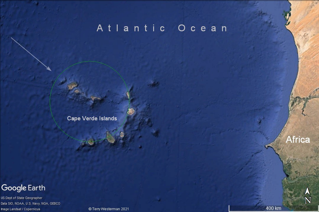 The Cape Verde Islands are an island group in the Atlantic Ocean located about 800 kilometers ( 500 miles ) West of Senagal and Mauritania in Northwest Africa. The islands are the upper tips of an ancient meteor impact crater of about 340 kilometes (214 miles) in diameter. The meteor came in from the Northwest. |

The 1260 km radius circle is noted primarily from the geographical formations along the inland circle line. The kmz file for this circle is HERE. Clicking on this link will either load the file on Google Earth, or download the file to disk, where clicking on that file will load it into Google Earth. |
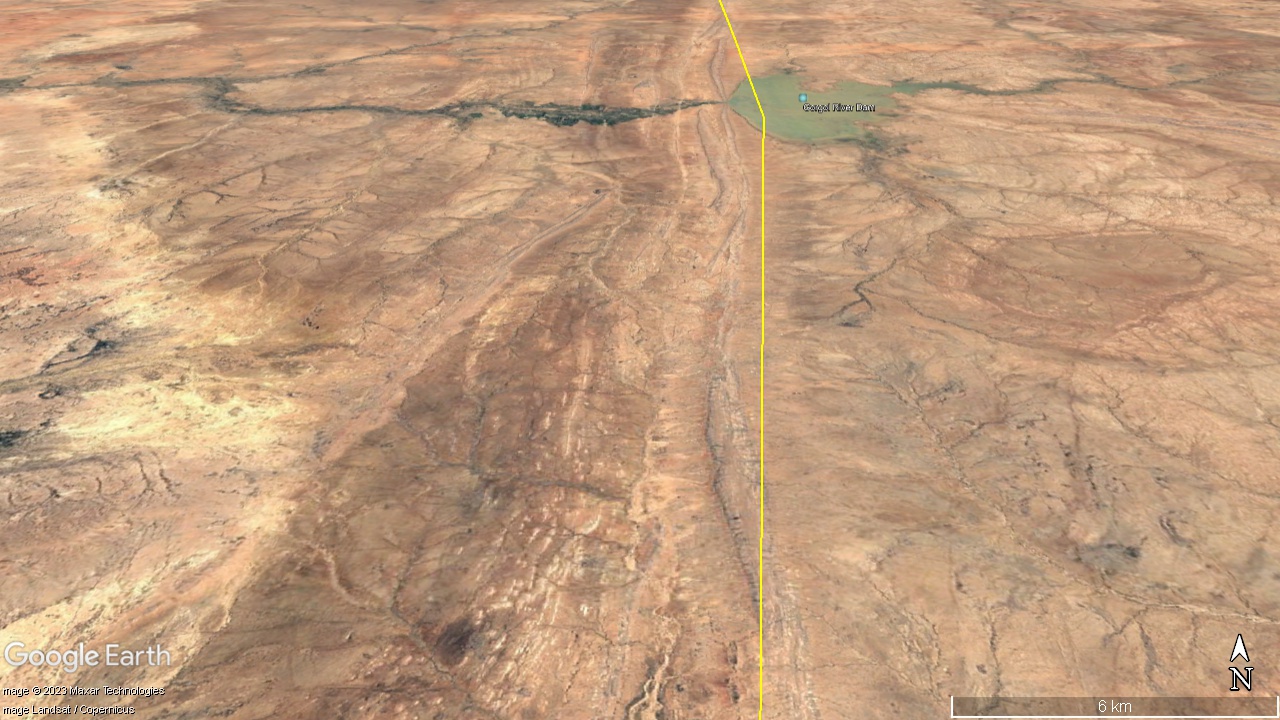
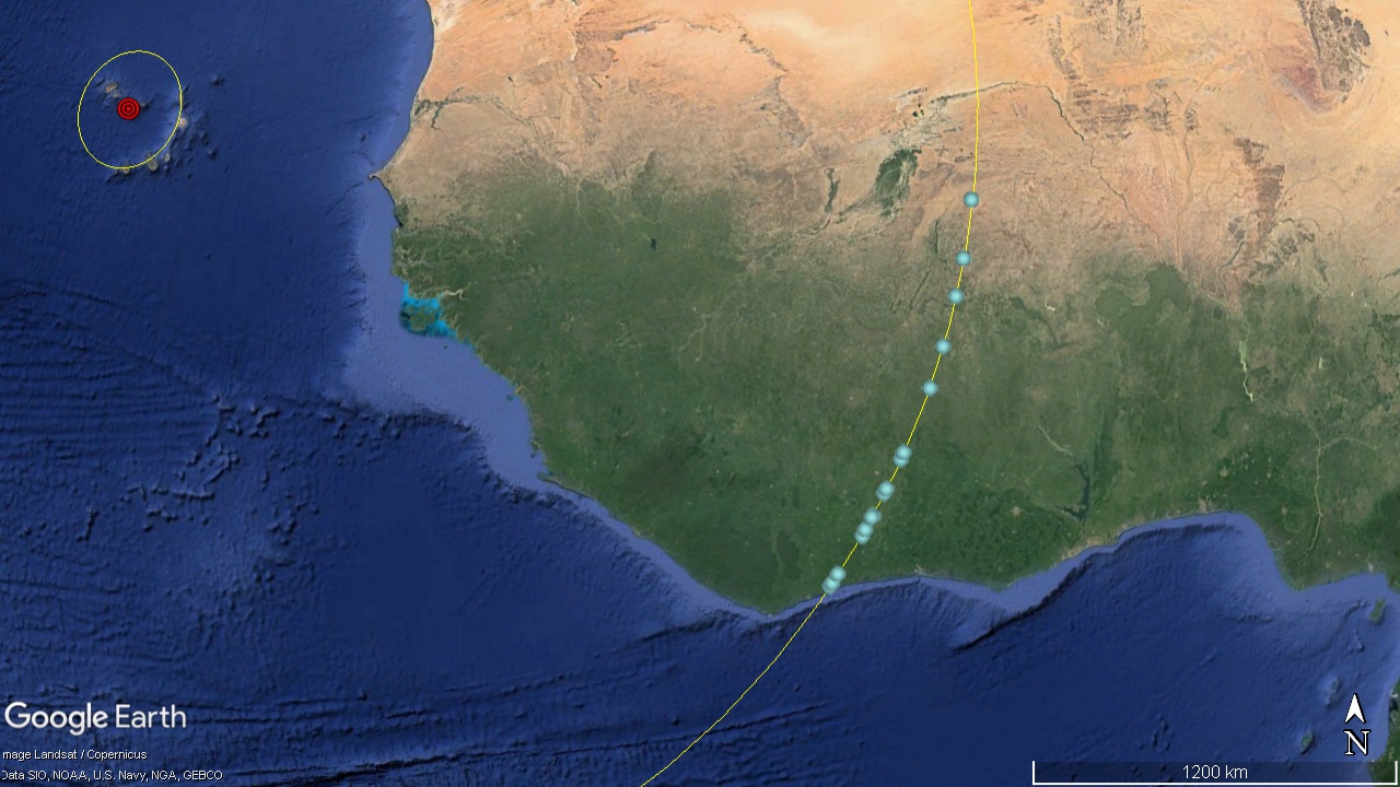
At 1260 km to the East there are a series of lines that look as if they could be the limits of the tsunami which occurred when the Cape Verde Impact hit. This is in Southern Mauritania. This series of lines is similar to, but much larger than, what might be seen on a beach at the high tide line. This line is 400 km inland and the surrounding land is 50 meters in elevation. That gives an idea as to how big this tsunami must have been. |
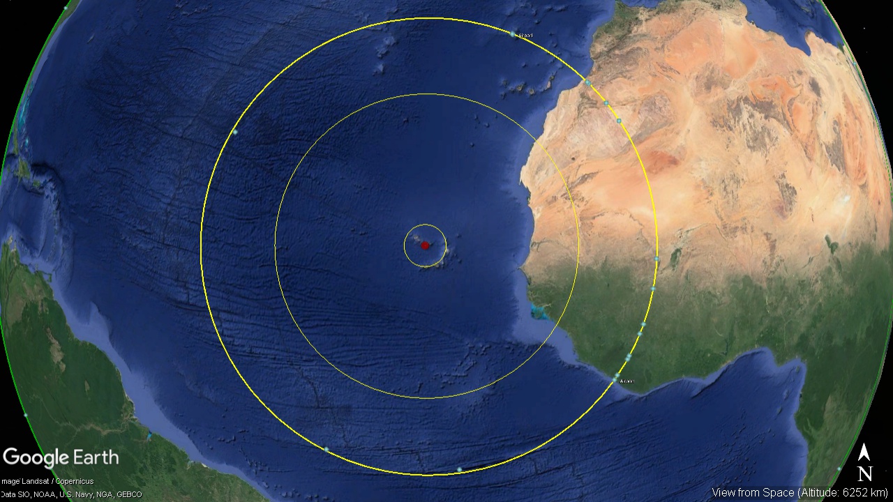
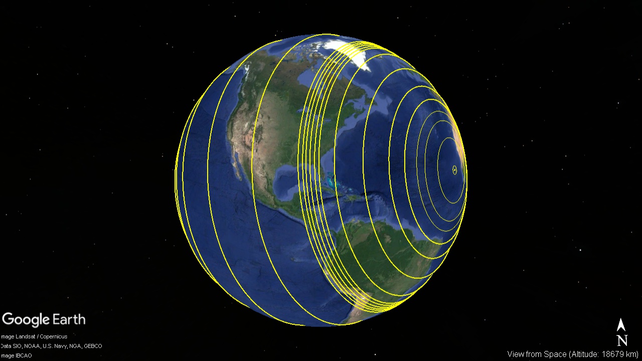
The seismic circle at 1964 km radius. The kmz file for this circle is HERE. |
|||||||

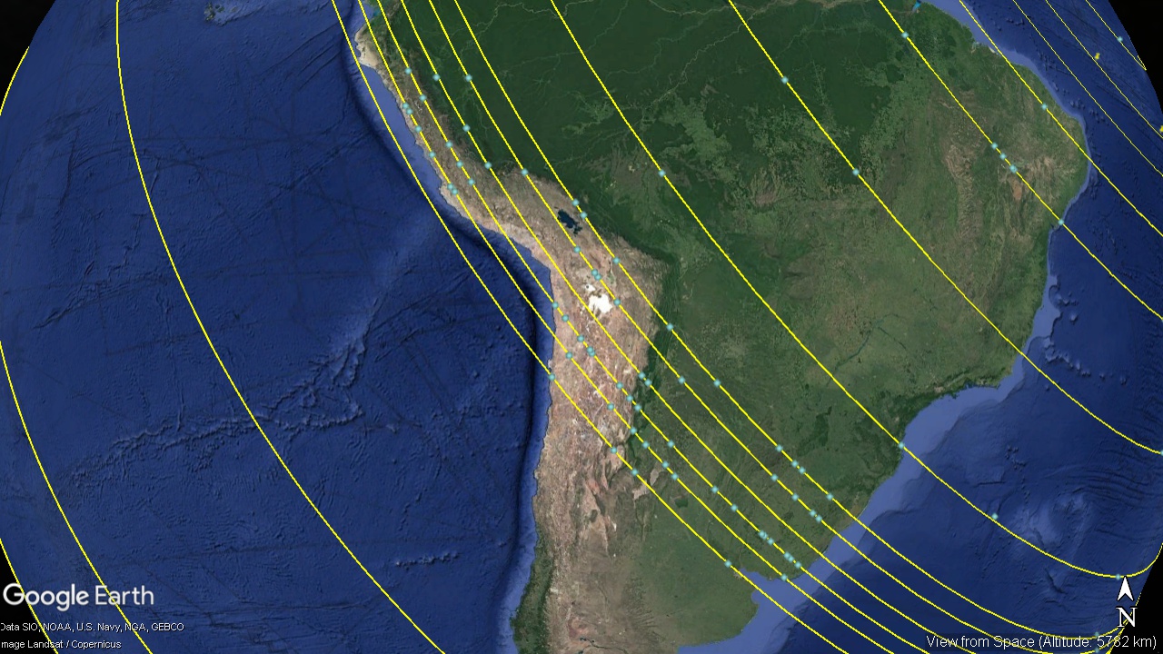
Perhaps the most striking part of this circle is to the South, La Romanche Fracture Zone. |
|||||||
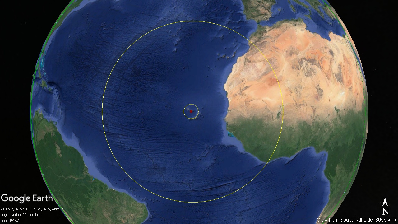
The seismic circle at 2365 km radius cracked the ocean floor and created the Mid Atlantic Ridge.The reason this has not been noted before is that the distortions needed to draw a near spherical object on a flat, 2 dimensional surface, distorts the geography so that a circle cannot be recognized. |
|||||||
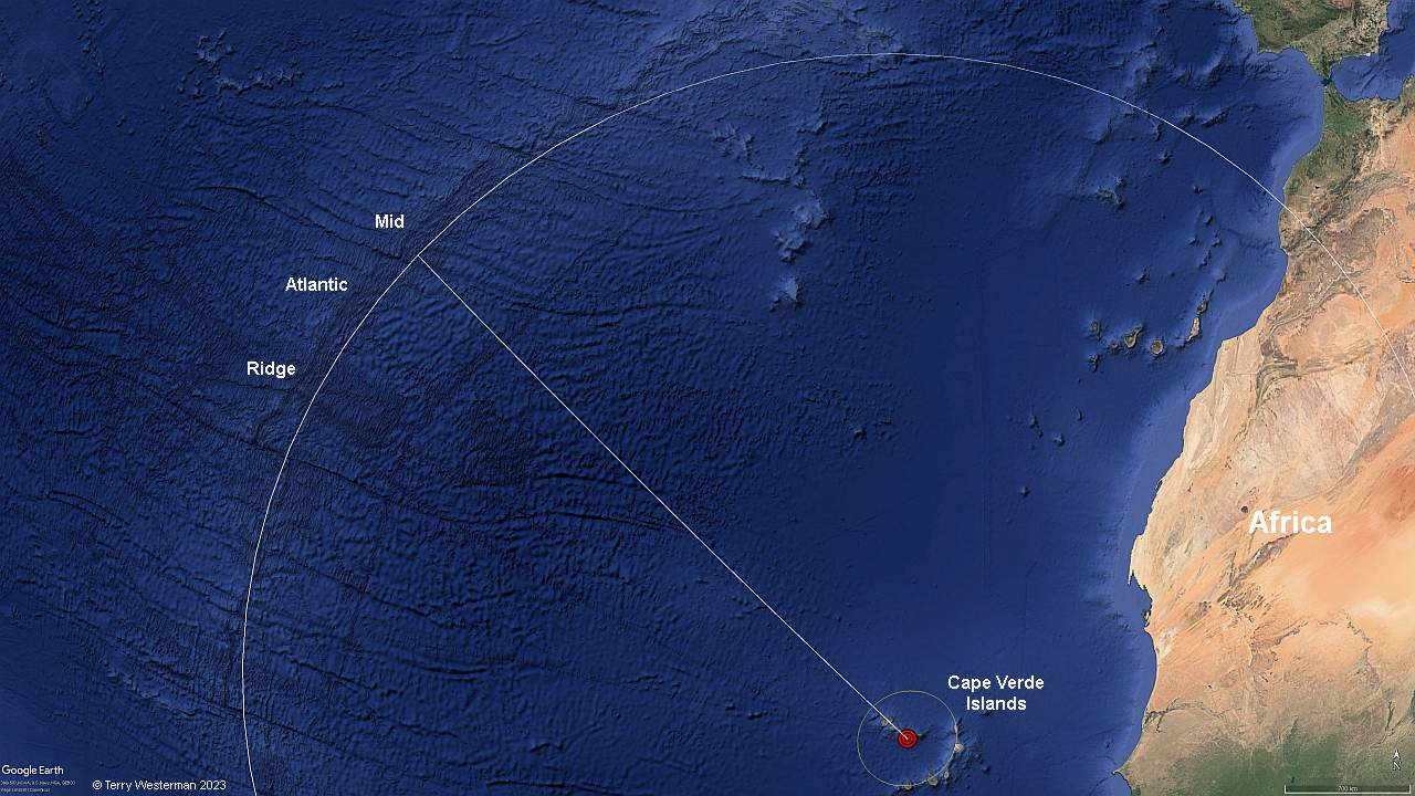
The Mid Atlantic Ridge follows the the circle precisely at a radius of 2365 km. |
|||||||

|