India
India
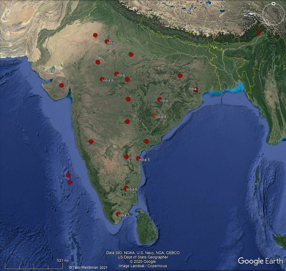
was formed by many meteor impacts. The red placemarks on the image
above denote the center of impact for some of them. Maybe you can
spot where other impacts happened. The placemarks with
a title in the image
above, such as India 4, can be examinrd by clicking on the .kmz
file, listed below. These files will open in Google Earth similar
to the image below.
If
you do not have Google Earth, get
it here.

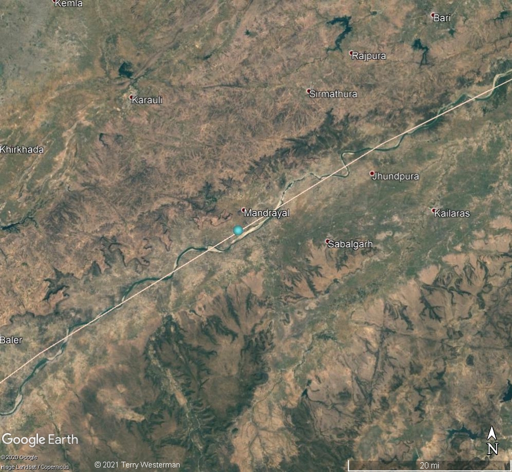
This
image of the India 4 impact shows the main seismic circles that
resulted from the impact. The blue placemarks denote the primary
geographic formations that fix the circle. By clicking on those
placemarks, you will be taken to a view of those formations, such
as the image below. From there you can take a closer look, if you
wish, and perhape you can find other formations around the circle
that are not marked.
India 1
India 2
India 3
India 4
India 5
India 6
India 7
India 8
India 9
India 10
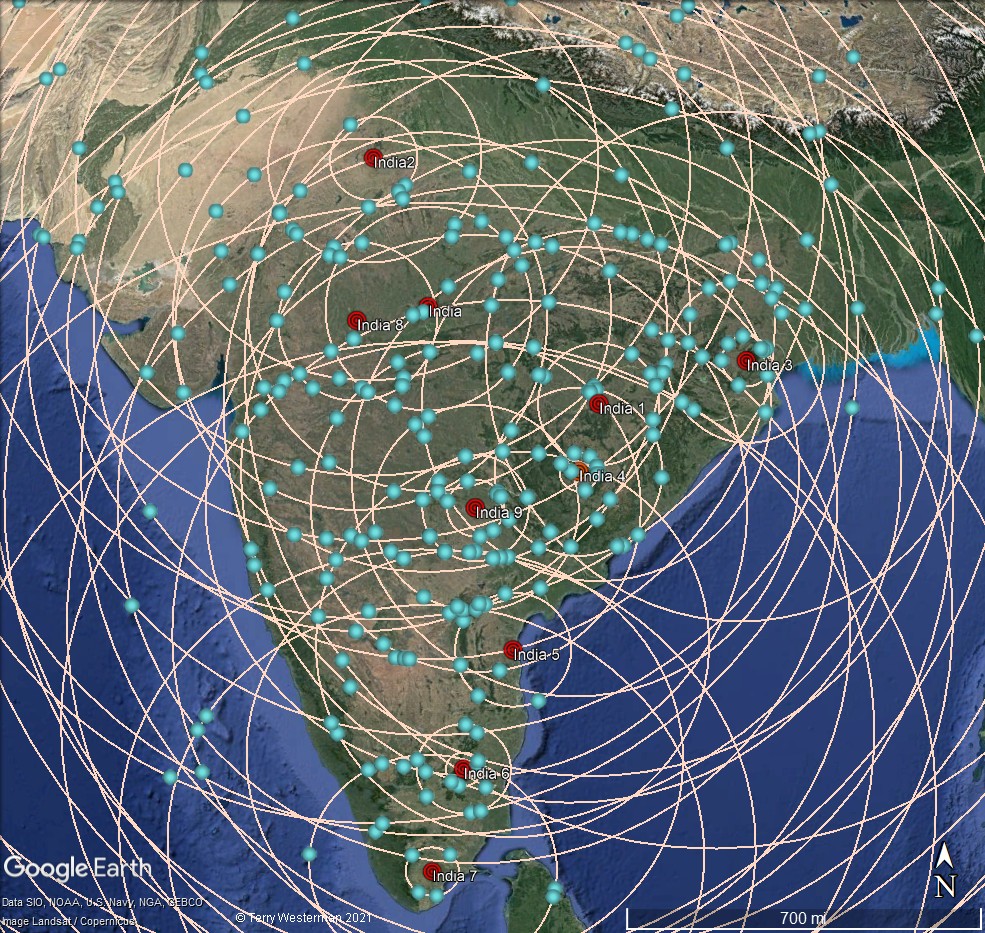
Of
you load all the kmz files at once, you get this. Somewhat
incomprehensible. But if you then zoom into those points where the
circles intersect, then the image below is an example of what you
see.

As
you study this, con start to see just how the land came together.
The seismic waves from different directions buckeling the land
along the circle lines. Then the water erosion forms the rivers
and streams.
Comments,
information, discussion, e-mail me
here:
twest@geoledgers.org
Index
of Impact Sites
© 2021 Terry Westerman