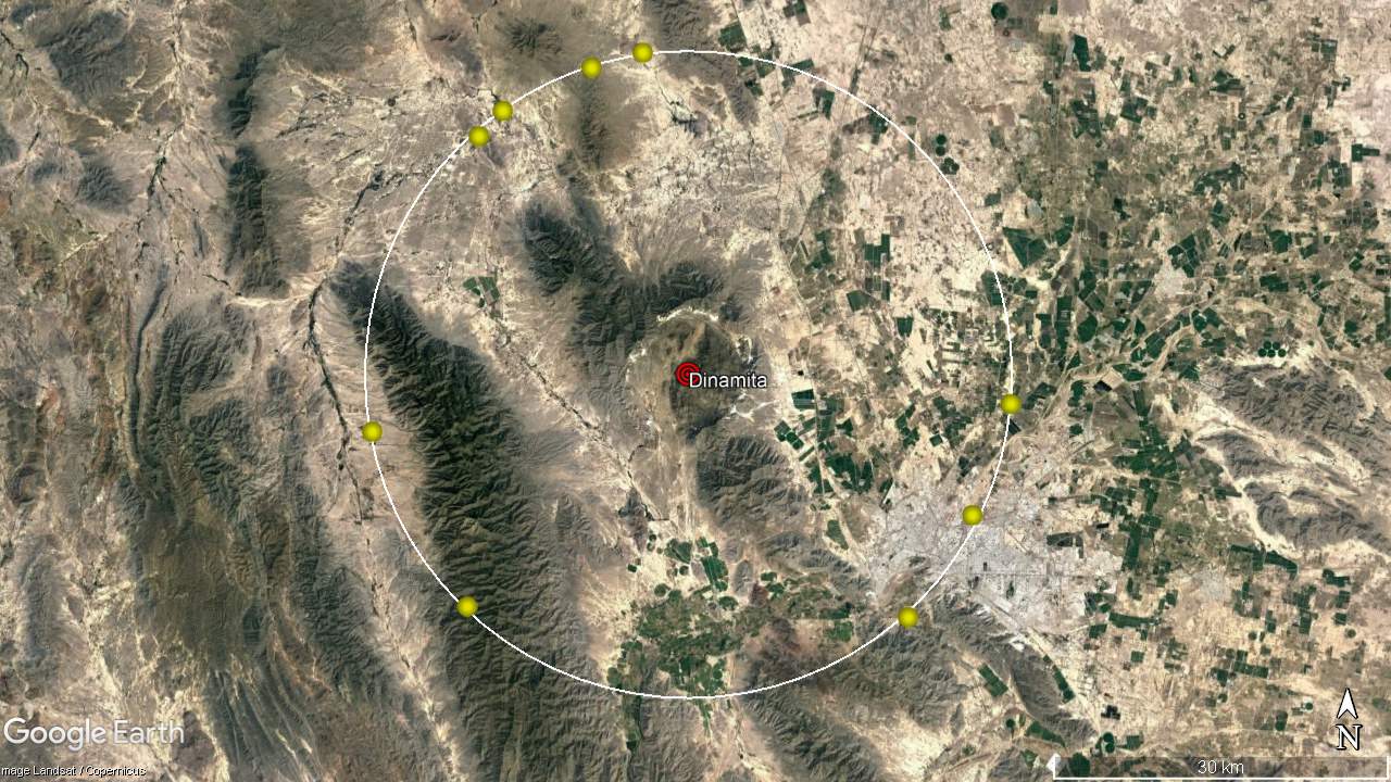
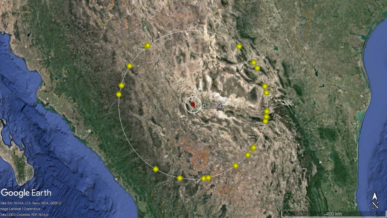
Advisory
If you arrived here by any means other than from the Index of Impacts,
it is suggested that you start at the Introduction to gain an understanding of what follows.


Dinamita Crater
Dinamita locater
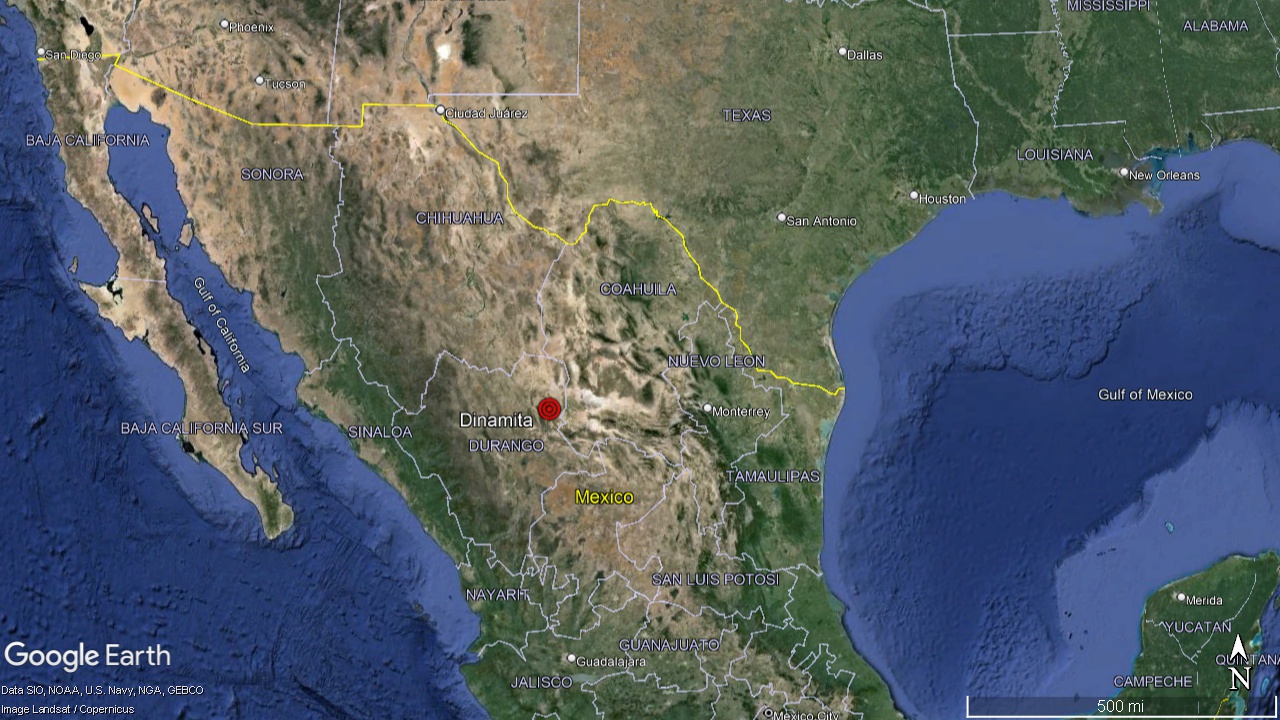
      This is an impact crater located in north central Mexico. It is located about 10 miles Northwest of Gomez Palacio, in North Eastern Durango State.
Dinamita meteor impact Locater
Dinamita Meteor Crater
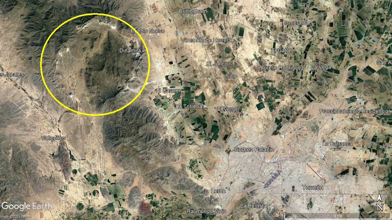
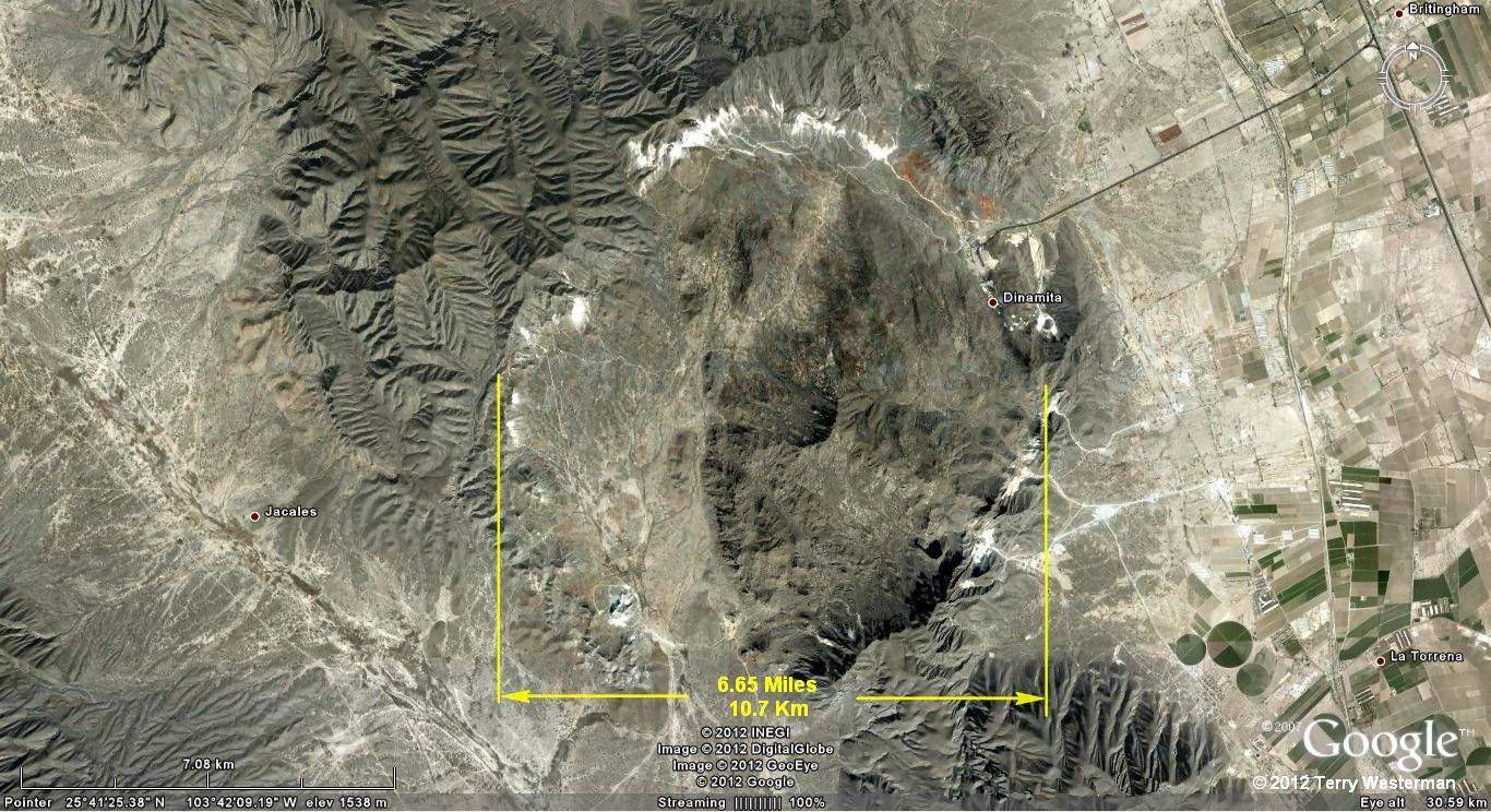
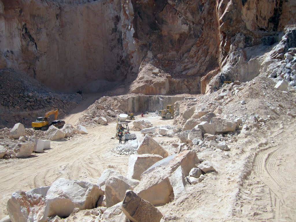
     The impact crater is about 6.65 miles (10.7 km) in diameter. The strike was in existing mountains.This is an important site for several reasons. The first is that it is here on Earth and it actually looks like an impact crater, which is rare. This shows the form of a heavy, dense asteroid impact, as opposed to a loosely packed comet type of impact. Since it hit in the mountains, it demonstrates that the primary blast ring expands outward in a circle, regardless of the actual angle of the hit, or the terrain that it passes through.
Dinamita Crater looking northeast
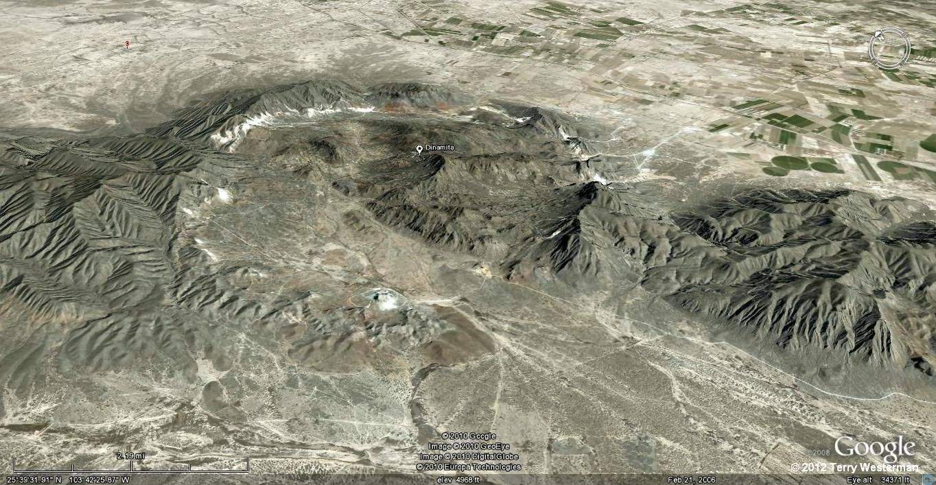
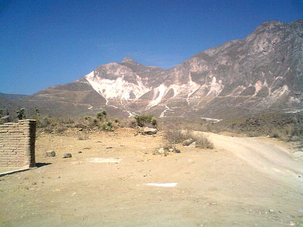
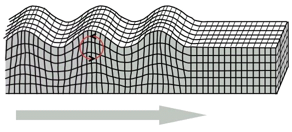
     Here in the mountains, the primary blast ring expanded over the rugged terrain, flattening the mountains that it hit. This image is looking to the northeast. It appears that the crater may have filled with water at one time, and then the rim broke, spilling the water to the lower right of the image.
Dinamita Crater looking west
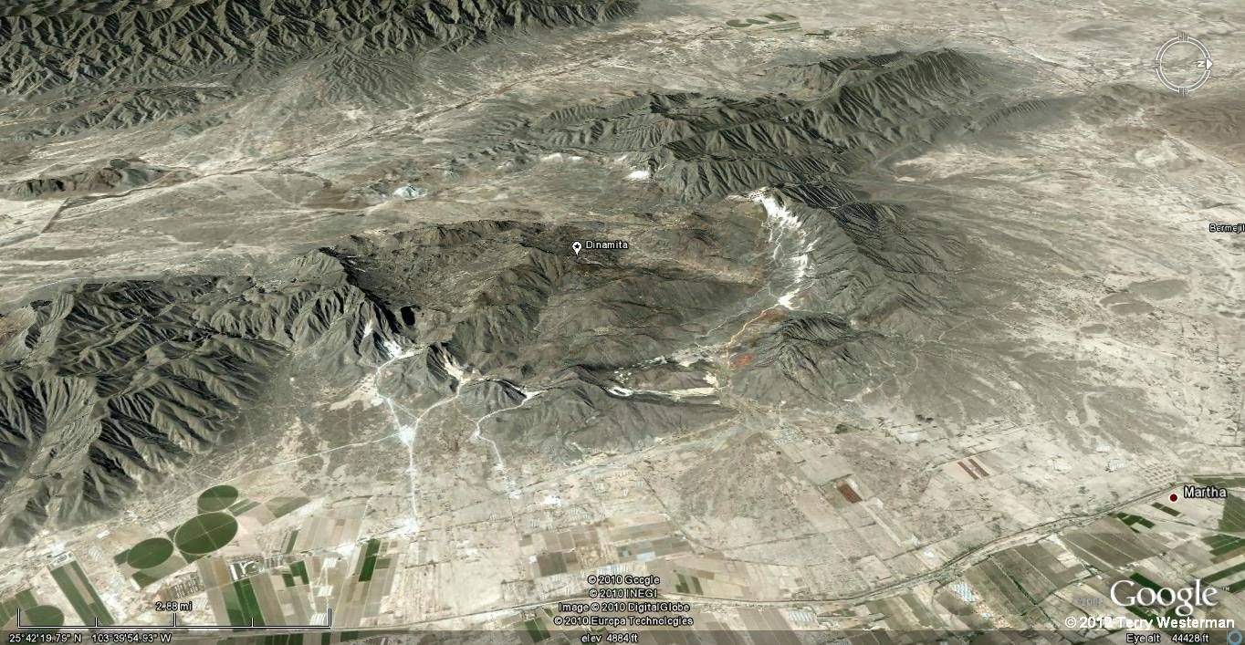
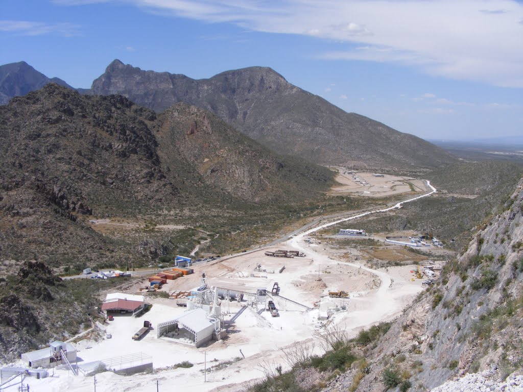
     Looking at the crater from the southeast to the northwest.


     The interior of the crater and the marbol mines.
The mining center at Dinamita.
      The central processing facility at Dinamita.

      Marbol from the Dinamita mines.

      Miming of marbol at the Dinamita impact site.

Dinamita Crater seismic circle at 29 kilometers.
     The seismic circle at 29 km radius.  A short movie that shows these features is HERE.
     The kmz file for this seismic circle is HERE!
     Depending on your browser, the .kmz file will either save to disk where you can click on it, and it will open in Google Earth, or it will open in Google Earth directly.
If you do not have Google Earth, you can get it here.
     By oppening the .kmz file, you can examine this circle in detail. The file will open in the left hand column under Places, Temporary Places. Click the arrow to the left of the Dinamita29km.kmz file to expamd the placemarks. Clicking on the placemarks top to bottom will take you on a tour of the major features which mark this circle. If you wish, you can explore these features in detail, and others you may see along the way.

The seismic circle at 266 km radius. The kmz file for this seismic circle is HERE!

These circles appear at various distances. The surface waves travel over the surface of the Earth, similar to ocean waves. Once they pass, there is little to show that they were there.


Rayleigh Wave diagram


 Rayleigh wave


There are also pressure waves that travel through the Earth at a different speed than the surface waves. The pressure waves rebound inside the Earth and sometimes meet with the Surface waves.


The combined amplitudes of these waves forms these circles and leaves a wave form on the surface of the Earth. As these passing waves roll the land, often times minerals that were below ground are exposed, and are then mined. As the wave leaves a hill and valley, the rivers and streams will follow the valley, and the hills will change the course of the water flow.

 As you follow these circle lines, the natural features you see most have to do with water, such as where rivers and streams flow, the location of reservoirs, where a river turns and where streams join. These all have to do with the highs and lows of the land.

Then we find that man uses these hills and valleys. Highly engineered works such as main highway intersections, bridges, airports and rail stations are often found on the circle lines, or just to the sides where the land is a little higher.

The seismic waves do not stop, they contunue, just as the ripples from a stone thrown into a still pond of water continue. Sometimes the seismic waves may be found all the way around the Earth. These are documented below.

     Many of the seismic circles from this impact are listed below. Could there be others?

     Depending on your browser, clicking on the links below will either load that circle's kmz file in Google Earth, or will save it to file where clicking on the kmz file will open it in Google Earth.
Dinamita29km
Dinamita266km
Dinamita355km
Dinamita489km
Dinamita856km
Dinamita1378km

Dinamita1933km
Dinamita2223km
Dinamita2328km
Dinamita2711km
Dinamita3200km
Dinamita3736km
Dinamita4410km
Dinamita5757km
Dinamita6950km
Dinamita8380km
Dinamita9241km
Dinamita11040km

Dinamita12880km
Dinamita15459km
Dinamita17008km
Dinamita18850km
DinamitaAntipode

Index of Impact Sites
Introduction
Comments, information, discussion, e-mail me here: twest@geoledgers.org

©2012, 2015, 2024 Terry Westerman