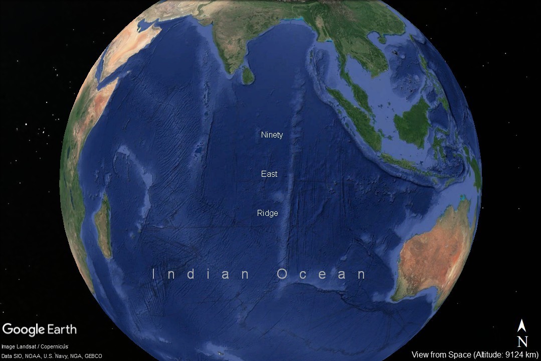
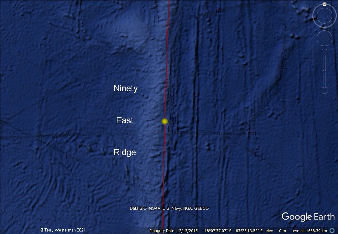
The Ninety East Ridge is a mid-ocean ridge on the Indian Ocean floor named for its near-parallel strike along the 90th meridian at the center of the Eastern Hemisphere. It is approximately 5,000 kilometers (3,100 mi) in length.

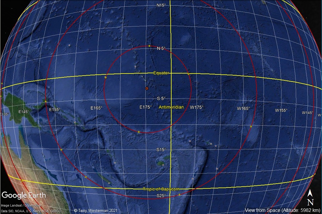
The Ninety East Ridge was produced by the seismic waves from an impact that hit just South of the Equator and just East of the Antimeridian.
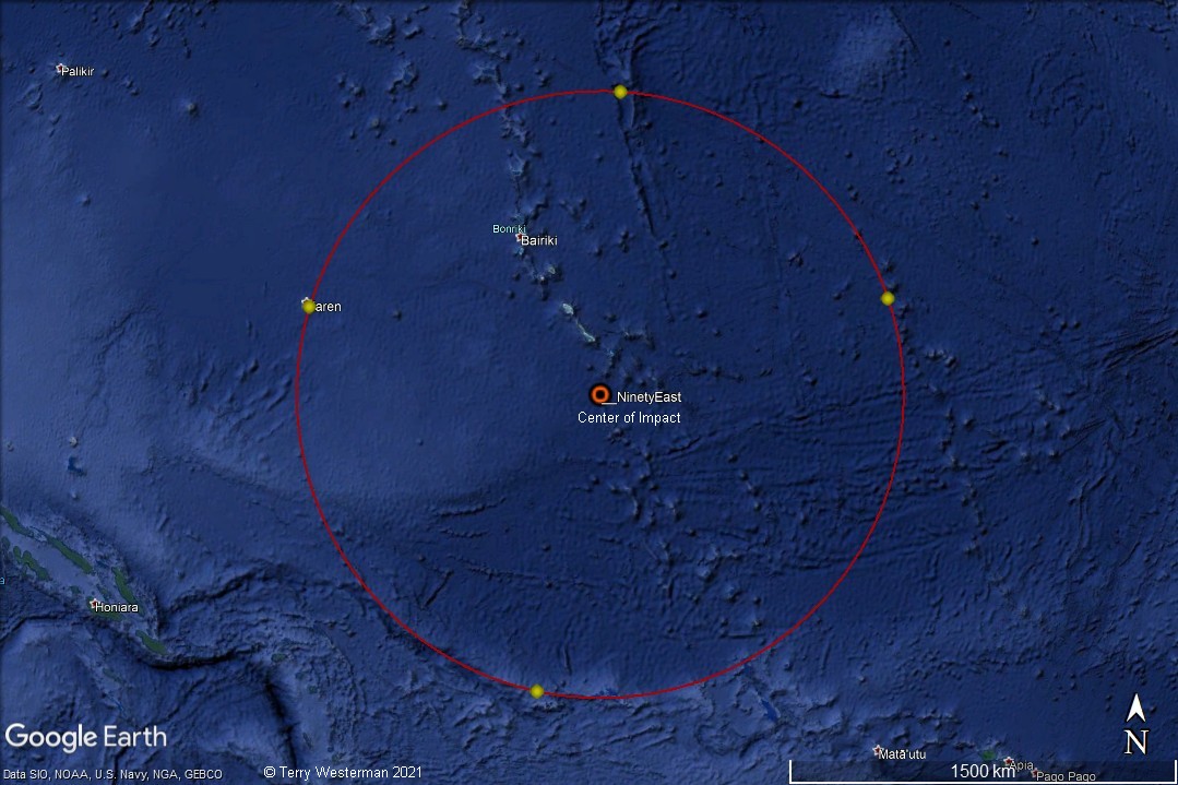
This meteor produced a primary crater of just over 1,900 km in diameter. As the ridge line to the south of the circle is an indication of direction, then the meteor came in at an angle of about 7 degrees, just off of due North.
The seismic waves produced by meteor impacts are similar to the circle waves produced when a stone is thrown into a still pond of water. The seismic waves move across the Earth in a way similar to the waves on the surface of the oceans, moving up and down while they roll the material they are moving through. If the surface waves have enough strength, they can roll the surface of the Earth to form the geographic formations that mark these seismic circles.

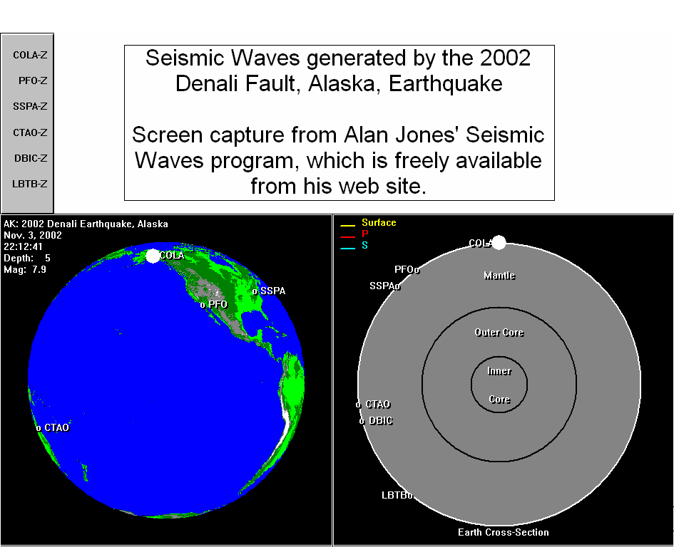
Then, there is another wave created from the impact, which is a pressure wave. This wave moves through the Earth and bounces around on the inside of the Earth. These two waves move at different speeds, and sometimes they come together, adding their forces, to form major rifts in the surface. Such is the Ninety East Ridge.
 <meta name="keywords" content="Mid Atlantic Ridge, Cape Verde
Islands, Meteor Impact, tsunami, seismic circles, Earth Formation">
<meta name="keywords" content="Mid Atlantic Ridge, Cape Verde
Islands, Meteor Impact, tsunami, seismic circles, Earth Formation">
<meta name="description" content="A meteor impact created the Cape Verde Islands, and caused the Mid Atlantic Rift">
<meta name="author" content="Terry Westerman">
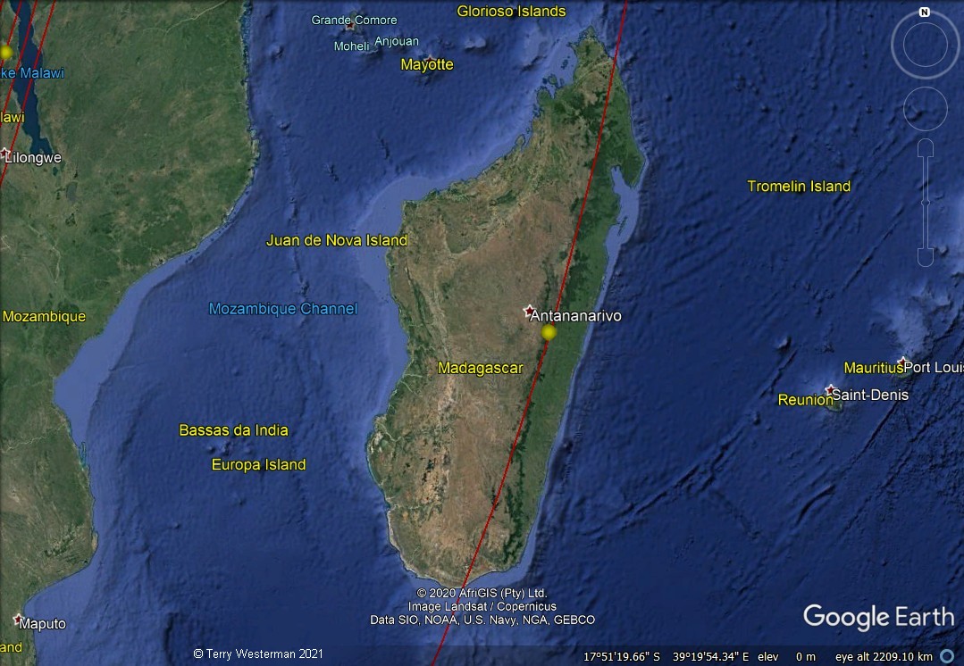
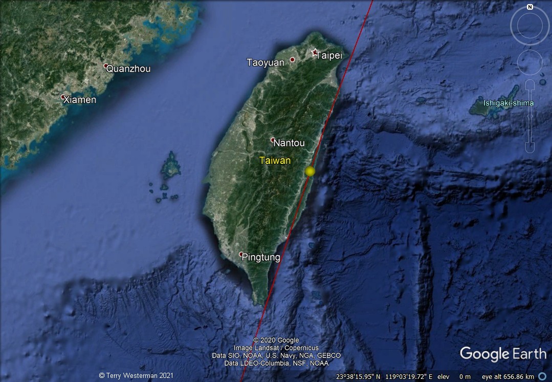
At 13,746 kilometers, the seismic wave lined the East Coast of Madagascar.
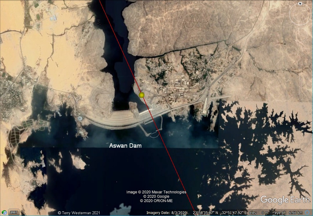
At 15,366 kilometers, the seismic circle aligns with the Aswan Dam in Egypt.
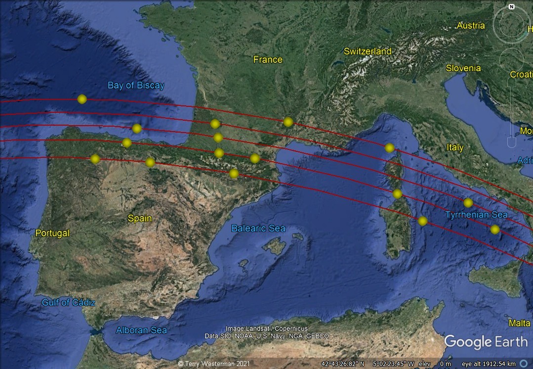
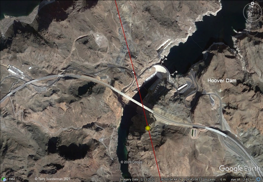
At times the seismic waves of the impact formed aligning
formations that occur one after another as the wave rolled across the
land. In the above image, with an effective altitude of about 1190
miles (1,913 km), the yellow dots mark some of these formations. Others
may be noted by closely studying the image. Many others can be seen
from a closer examination of the circles.
The kmz
file for the Ninety East Ridge Impact is HERE It shows 15 seismic circles and
the major formations that demonstrate each circle. This file will open
in Google Earth. If you do not have Google Earth, get it
here.
Once loaded into Google Earth, expand the kmz file in
the left hand column by clicking the arrow to the left of the file,
then expand each circle by clicking the arrow to the left of the circle
name. A number of placemarks will appear below each circle name. By
clicking each placemark, you will be taken to that geographic formation
which describes the circle. We are looking for formations of many kinds
that closely follow the circle line. Should you wish, you can zoom in
from there to examine the formations more closely. This kmz file only
describes the most obvious formations. By following the circles
closely, you may find many more, and you may find other circles as well.
Comments,
information, discussion, e-mail me here:
twest@geoledgers.com
Index of Impact Sites
© 2021 Terry Westerman