Advisory If you arrived here by any means other than from the Index of Impacts
 It is suggested that you start at the Introductionto gain an understanding of what follows.

Barringer Meteor Crater


Barringer Crater Location, between Flagstaff and Winslow, Arizona.
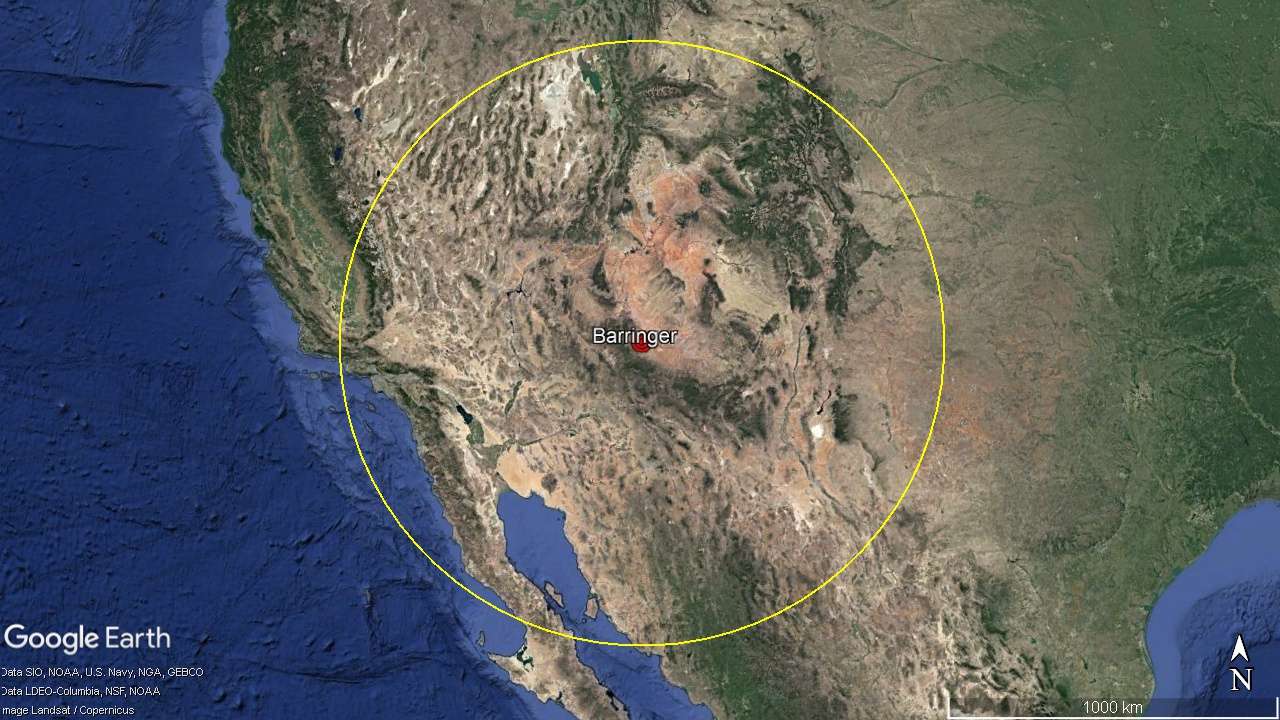
Barringer Meteor Crater is located in Arizona State between Flagstaff and Winslow. It is a confirmed impact crater and it is small enough that the effects of this impact can be studied on the ground and then be compared to other impacts. Barringer Crater, possible rays from the blast of the meteor.
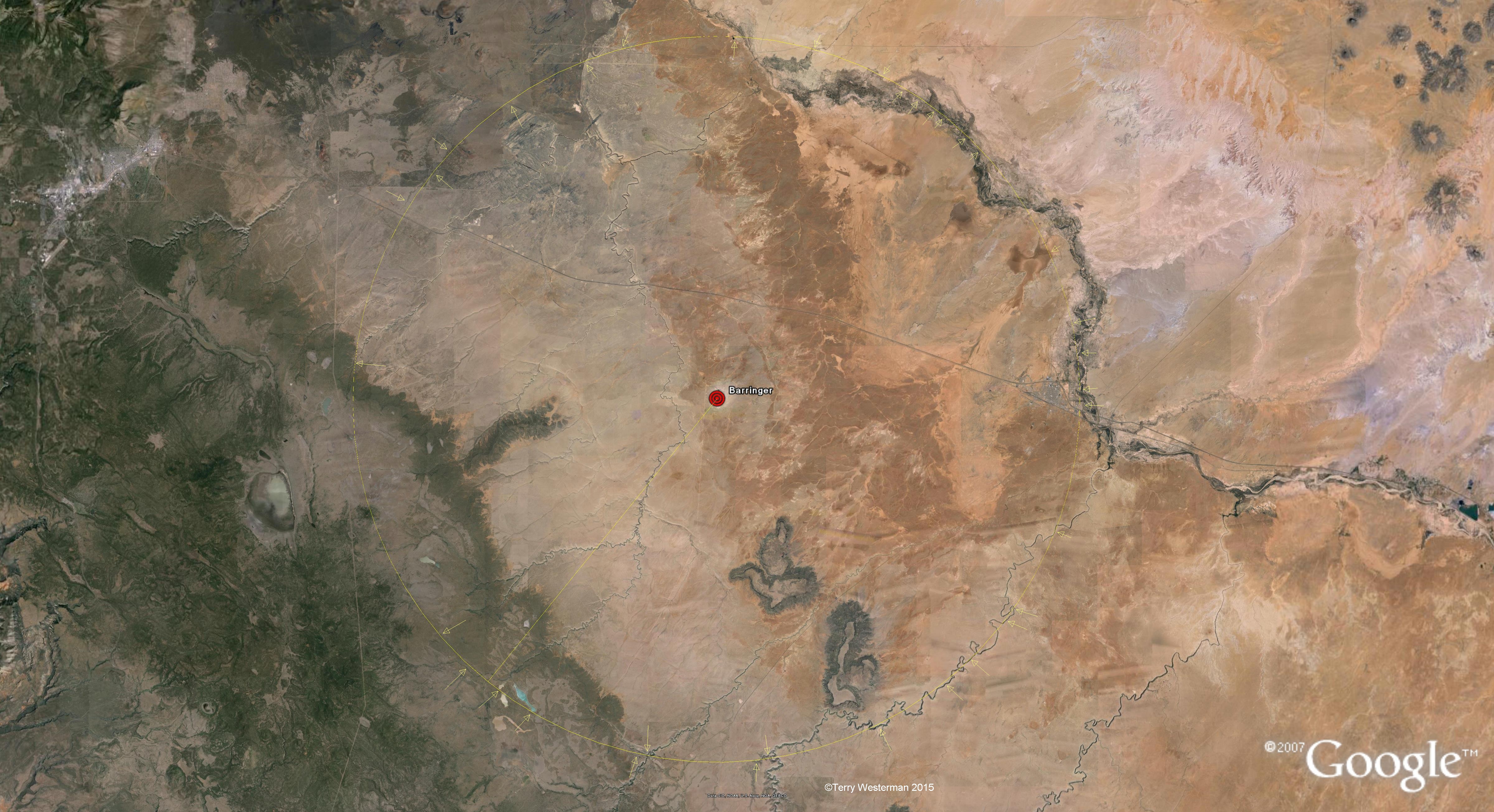
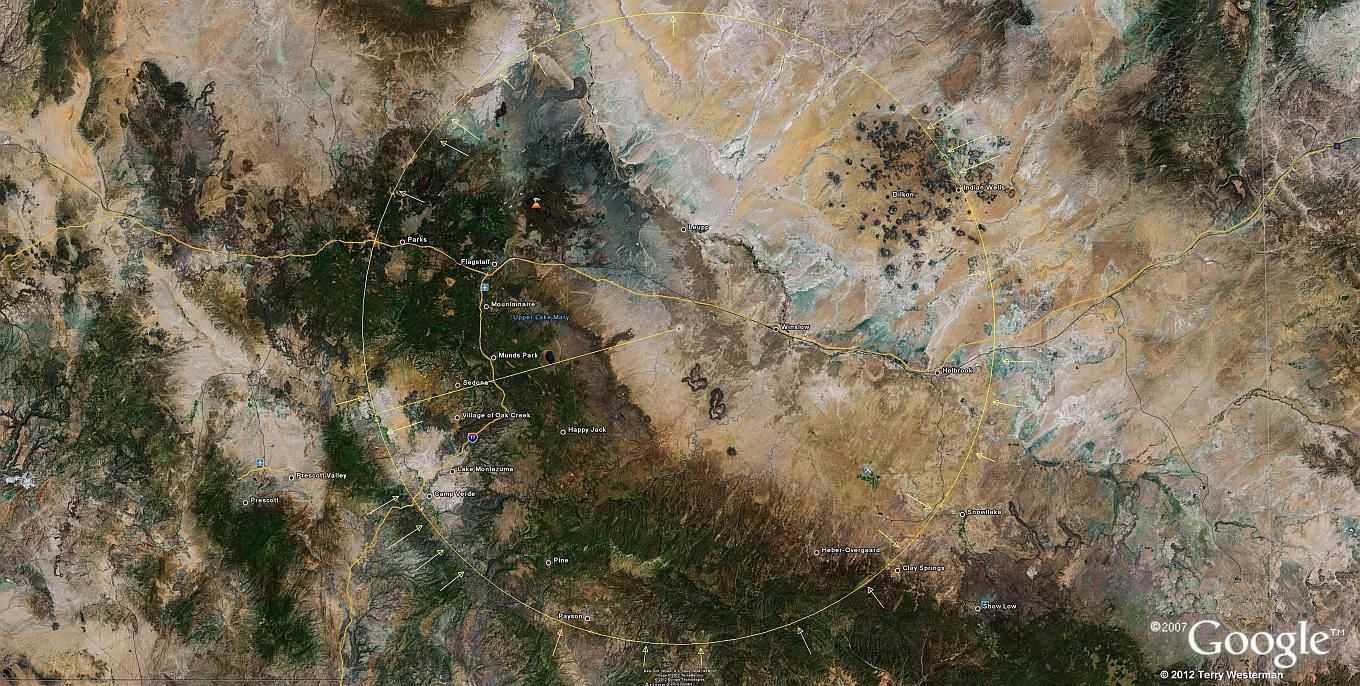
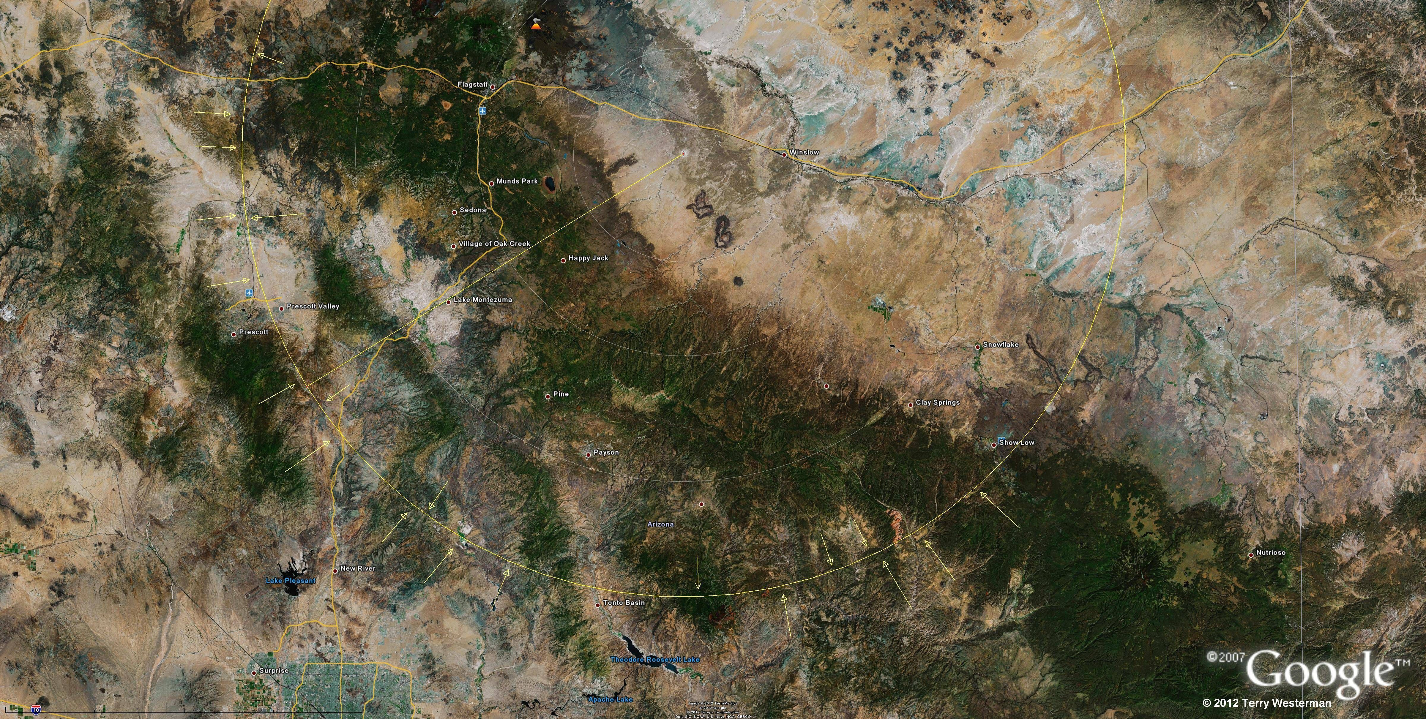
     A very wide view of the area shows lines in the geography radiating from the impact site. These were possibly caused by meteor fragments that blasted off when the meteor hit the ground. The direction of these rays also suggests that the meteor came in from the southwest. This image is from an apparent altitude of about 300 miles. The image is linked to a larger image for more definition.
Barringer Crater marking the center of the crater.
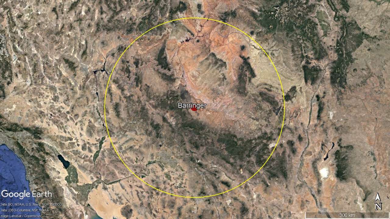
     The crater is about 0.37 miles in radius, or 0.73 miles in diameter, just over 1 km. The center has been marked and surveyed many times, but is generally taken as the center of the best fit circle, as shown above. However it is not just the crater that defines this impact. The crater is 560 feet deep ( 170 m). The force of an impact that blew a hole in the Earth of this size is far more than the forces of all the bombs ever exploded by man. Yet this is a relatively small impact crater. The effects of this impact were felt world wide.The impact produced circular seismic waves in the surrounding earth which reformed the Earth according to those waves.
Barringer Crater shown with the ejecta pattern in line with the line between the center of impact and the center of the crater, and the first shock wave circle at 1.24 miles radius.
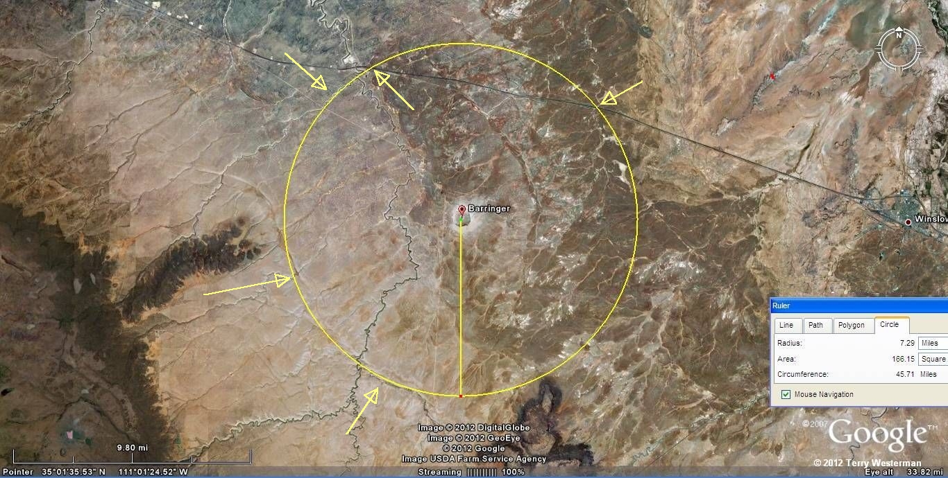
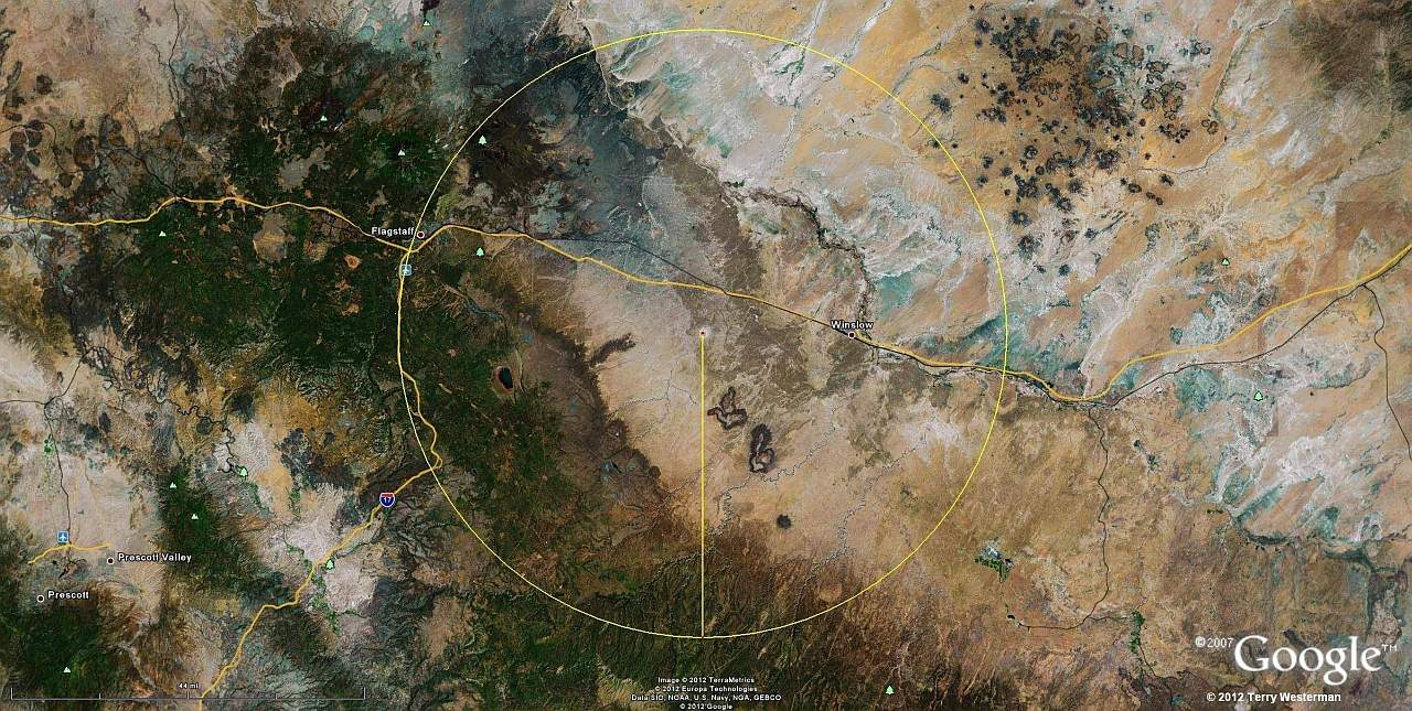
      With a wider view the ejecta pattern can be seen. The yellow line describes the pattern from Southwest to Northeast, in the same direction as the line between the two center points. This indicates that the meteor came in from the Southwest. The Center of Impact then, would be the place where the meteor first hit the Earth. The larger circle at 1.24 miles radius, shows the first instance of the seismic circles from the impact. These seismic waves radiate out from the center in concentric circles, similar to the ripples in the water if you throw a stone into a still pond.
Barringer Crater, the 7 mile seismic wave circle.
      At 7 miles radius, the seismic wave left its marks.          The .kmz file for this circle is HERE. This will open in Google Earth and allows a closer examination of this circle.
When viewing the .kmz file in Google Earth, it is recommended that you open the placemarks in the left hand column, and click on the placemarks top to bottom. This will give you a tour of each of the circles, and you will be able to stop to examine other features along the way, if you wish

Barringer Crater, the 20 mile seismic wave circle.
     At 20 miles radius the seismic circle cuts through Winslow, Arizona. To the Northeast is the Little Colorado River. To the Southeast is Clear Creek. Starting to the Northwest.....                     
This image is linked to a large, hi res image for increased detail.     The .kmz file for this circle is HERE. This will open in Google Earth.               
     When the .kmz file is opened in Google Earth, you can examine the circle in detail. I recommend this as there are many smaller features, too many to placemark each one.

Barringer Meteor Crater 37.5 mi radius, seismic circle
      At 37.5 Miles Radius a very interesting seismic circle.  The .kmz file for this circle is HERE. This will open in Google Earth
                                                                                                                                                                                  

Barringer Meteor Crater 51 mi radius, seismic circle
Above, the 51 mile radius seismic circle. The .kmz file is HERE. This will open in Google Earth and from there you can see each of the placemarks in the above image, as well as you can closely examine the circle for other geographical features that coincide with the circle.                                                                                    


Barringer Meteor Crater 61mi radius, seismic circle
     The 61 mile radius seismic wave circle is shown in its entirety, with numerous deformations of the land marked by the arrows.  This image is at an apparent altitude of 230 miles.
The .kmz file is HERE! Click on the link to open it in Google Earth.

Barringer Meteor Crater 81 mi radius, seismic circle
     The southern section of this 81 mile radius seismic circle of the Barringer Crater. It is linked to an image 4,800 pixels in width for increased definition. Many of the geographical
formations caused by the seismic wave are arrowed. As this image is effectively from an altitude of 225 miles, being able to see this formation at that distance gives an idea as
to the energy involved in this impact. A closer examination of this circle will show all forms of human endeavor; roads, reservoirs, railroads, airports, cities and more as well as
the natural features of river/stream valleys, and other geographical phenomena which clearly define this circle.   The .kmz file is HERE!

Barringer Meteor Crater 187 mi radius, seismic circle
     At 187 miles.   The .kmz file is HERE!       

Barringer Meteor Crater 476 mi radius, seismic circle
     The 476 mile radius seismic circle .
                        The .kmz file is HERE!    
  
There are many other seismic circles as the seismic waves from this impact traveled around the world.
Below are the circles that I have noted. There may be more. Click on the links to open them in Google Earth.

The .kmz files for other circles are here:
Barringer7mi
Barringer20mi
Barringer37mi
Barringer51mi
Barringer61mi
Barringer77mi
Barringer81mi
Barringer179mi
Barringer183mi
Barringer187Mi
Barringer247Mi


Barringer367mi
Barringer476Mi
Barringer599mi
Barringer831mi
Barringer998mi
Barringer1146mi
Barringer1340mi
Barringer1801mi
Barringer2420Mi
Barringer2830mi


Barringer3222mi
Barringer3750mi
Barringer3910mi
Barringer4299mi
Barringer4780mi
Barringer5485mi
Barringer5818mi
Barringer6104mi
Barringer6250m
Barringer6615mi           

Barringer7103mi
Barringer7420Mi  
Barringer7870mi
Barringer8374mi
Barringer8810mi
Barringer9620Mi
Barringer10246mi
Barringer10905Mi
Barringer11518mi
Barringer11960mi      


Questions, Comments e-mail me here:
twest@geoledgers.org
Index of Impact Sites
Introduction
©2012, 2015, 2023 Terry Westerman