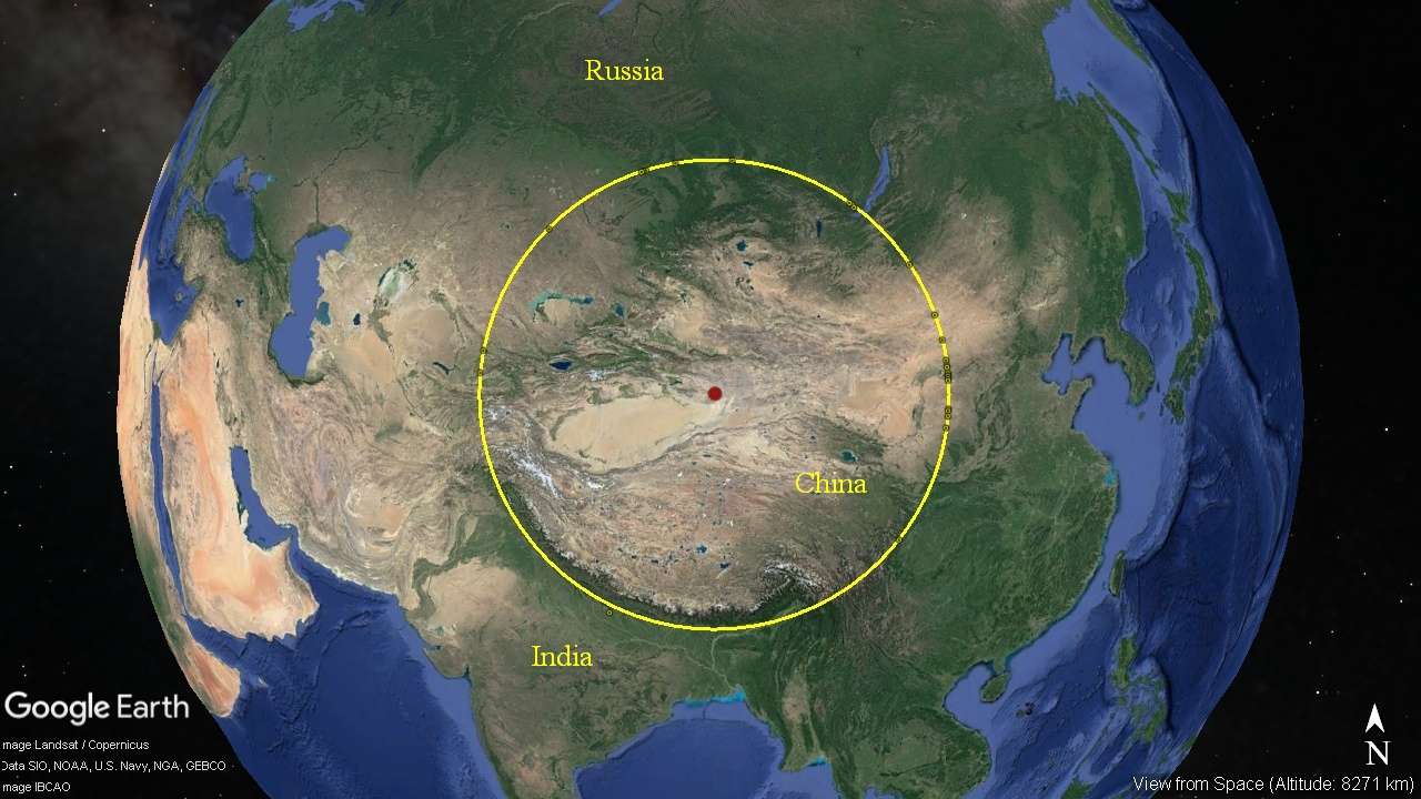
 The Himalayan Mountains were made by a very old, and probably the
largest meteor impact still visable today. The .kmz file for this
circle is HERE!
The Himalayan Mountains were made by a very old, and probably the
largest meteor impact still visable today. The .kmz file for this
circle is HERE!
Depending on your browser, the .kmz file will either save to disk where you can click on it, and it will open in Google Earth, or it will open in Google Earth directly. By oppening the .kmz file, you can examine this circle in detail. The file will open in the left hand column under Places, Temporary Places. Click the arrow to the left of the Him1635km.kmz file to expamd the placemarks. Clicking on the placemarks top to bottom will take you on a tour of the major features which mark this circle. If you wish, you can explore these features in detail, and others you may see along the way.
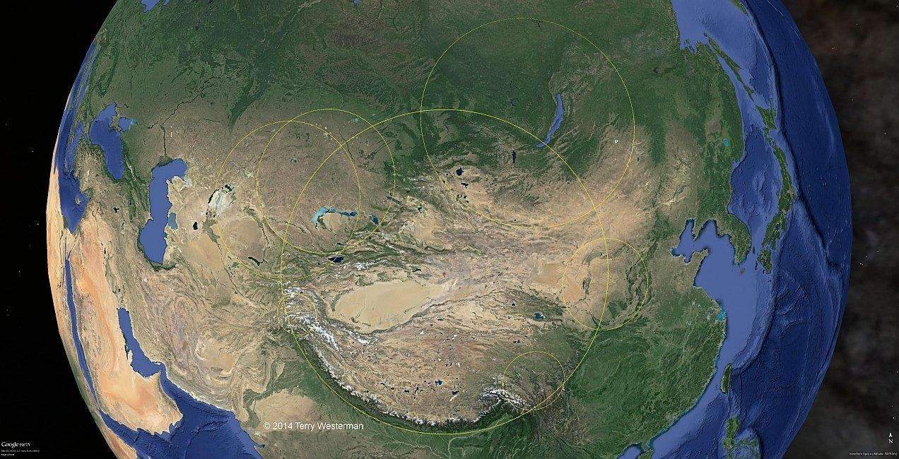
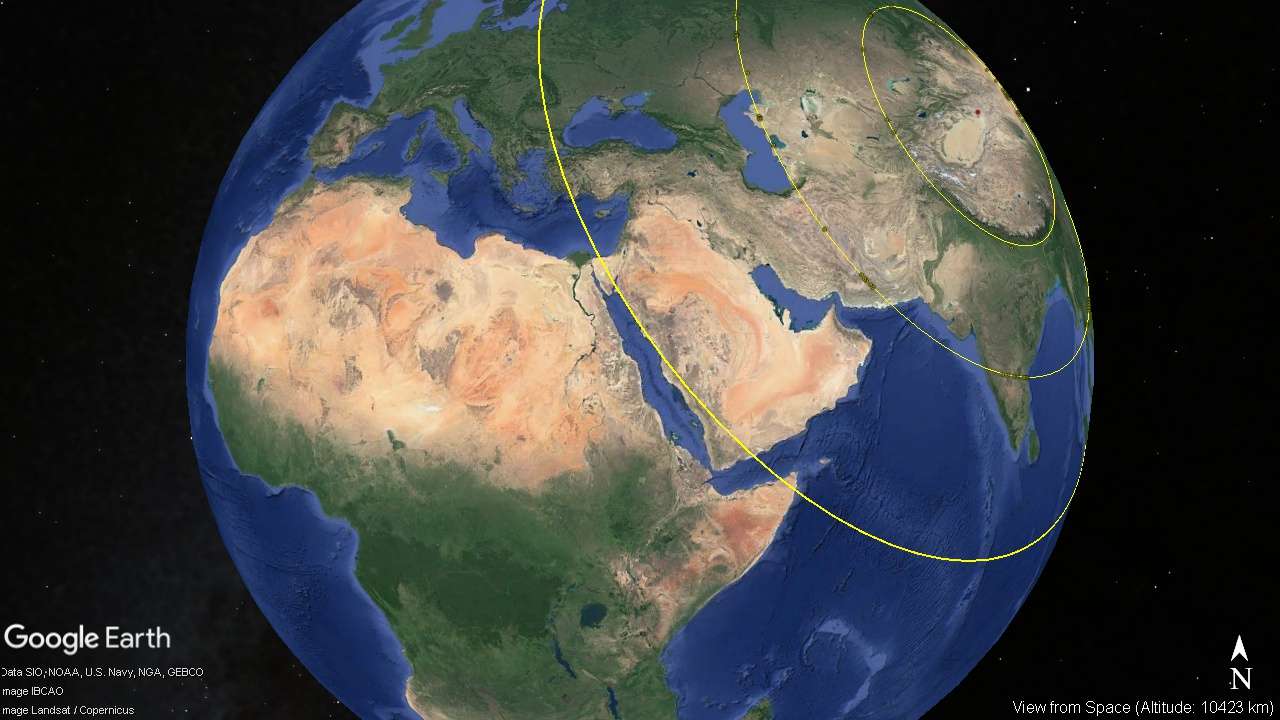
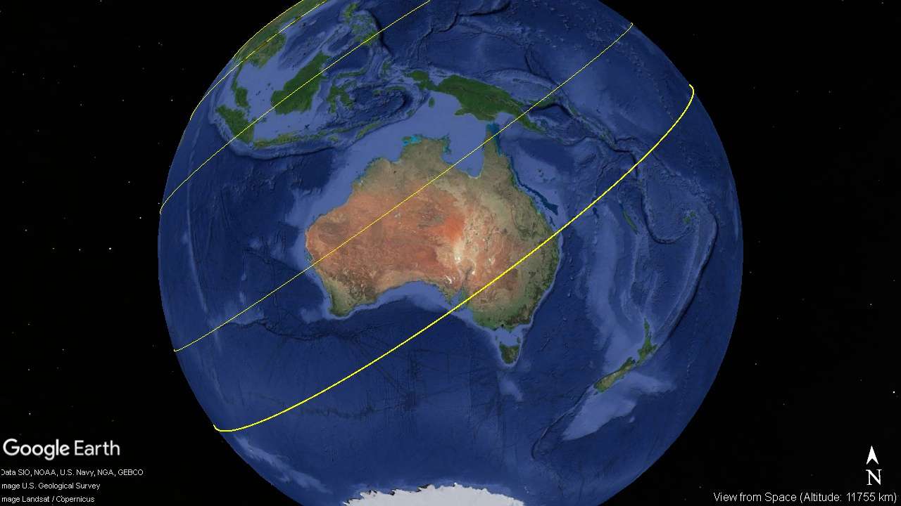
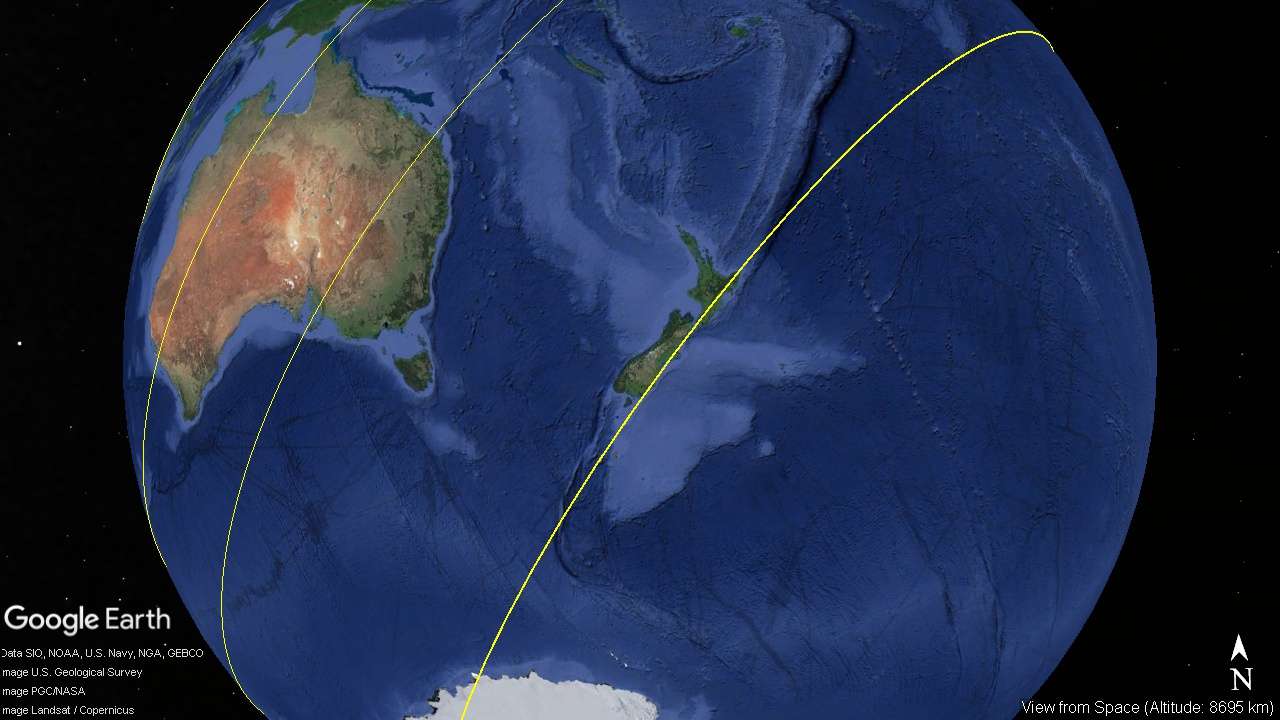
The image above is the Himalayan Impact, 1635 kilometer seismic circle, overlaid with several circles showing the locations of impacts that came after the Himalayan. There are many more. These later impacts, broke the form of the Himalayan Impact in many places. Showing the various impacts this way, the reason for the various forms of the geography in the region start to emerge. This also gives the basis for developing an age scale based on the various impacts. The Himalayan Impact must be very old to have been hit this many times after it struck the Earth. If you study this image, you may find many other arcs, parts of circles. If the proper sized circle were to be fitted into those arcs, other impact sites would show themselves.
Note that the smaller circles appear to be somewhat oval. This is because of the curvature of the Earth being represented in two dimensions. Each of these circles follow geographic land formations that have been photographed using the finest satellite imagery available today.
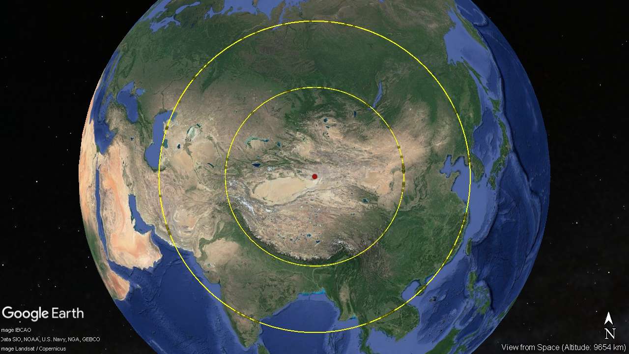
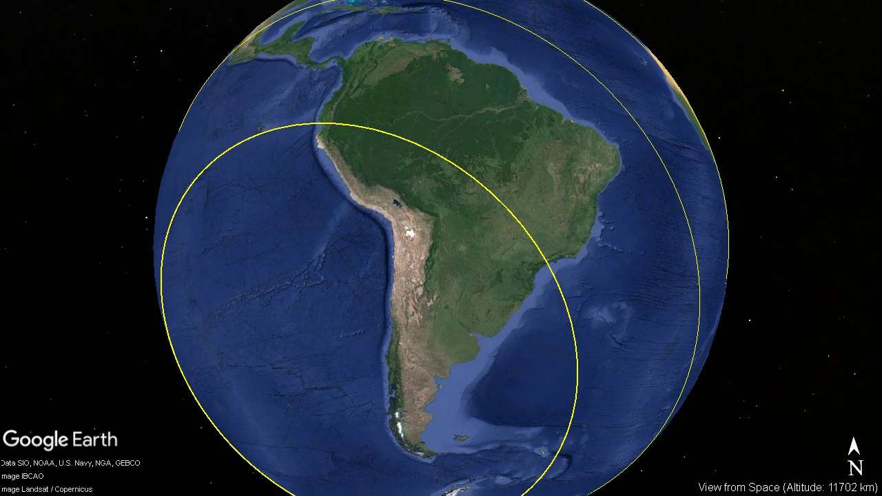
 The 260 kilometer radius circle. This center is probably not where the meteor ended up, but is the center of the concentric circle shock waves, seismic circles, that emanate from the impact.
See the Barringer Impact for a discussion of this.
The 260 kilometer radius circle. This center is probably not where the meteor ended up, but is the center of the concentric circle shock waves, seismic circles, that emanate from the impact.
See the Barringer Impact for a discussion of this.
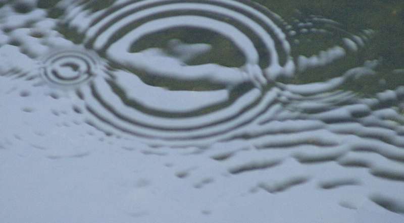
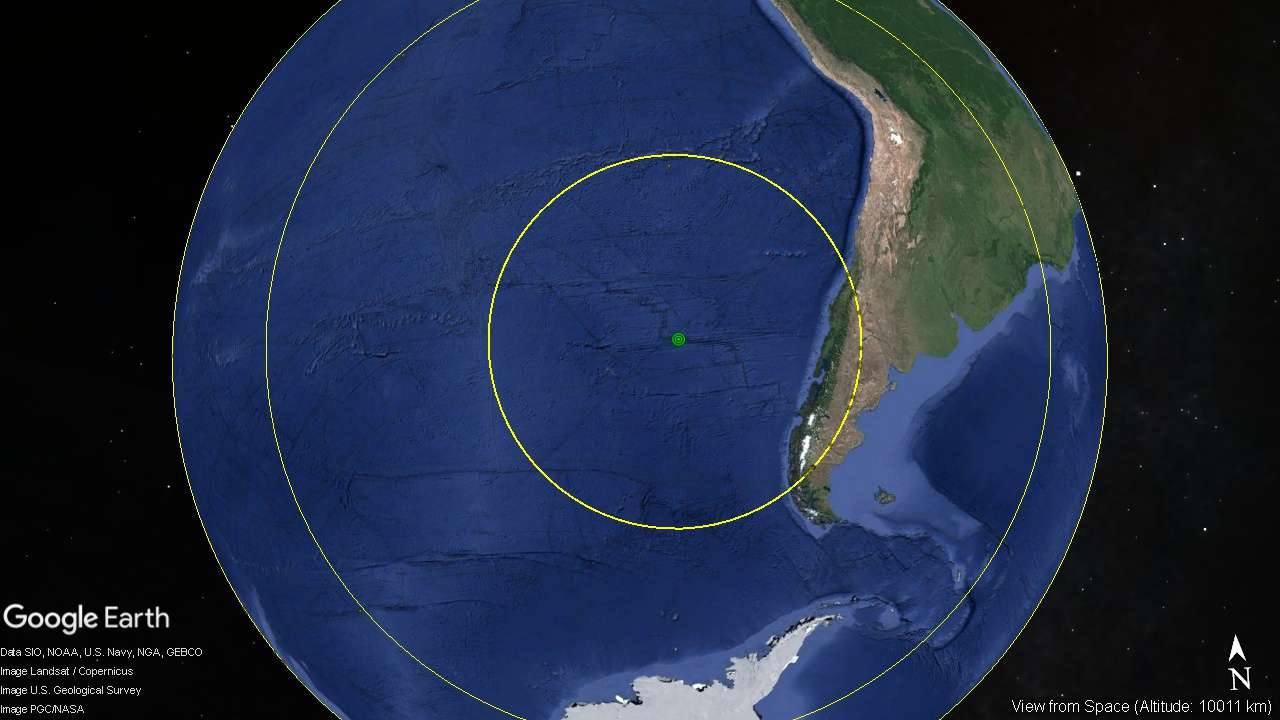
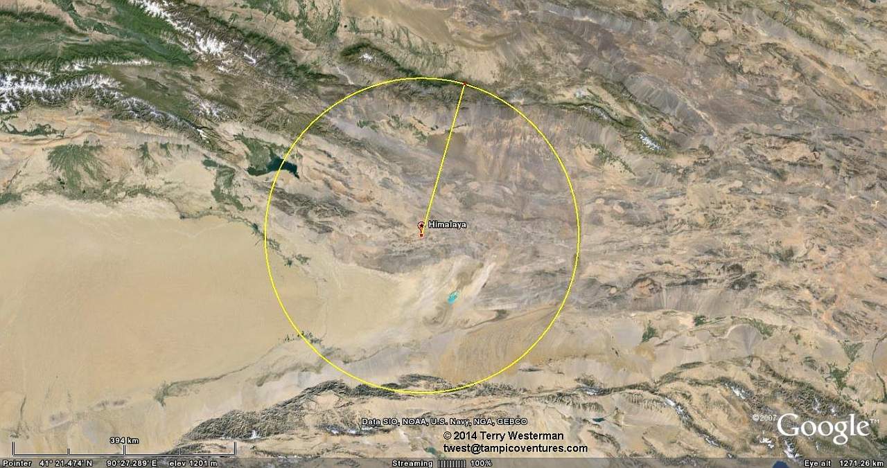
So where is the meteor? Probably it is the Tibetan Plateau, or is under it, causing that area to rise to 5,000 meters elevation, 4,000 meters above the surrounding landscape. This point is where everything rebounded to after impact, and from there the concentric circle, seismic waves emanate. Think of throwing a big rock into the water. The water first parts, making a hole. Then it comes back together, and the expanding perfect circles in the water follow. Afterward there is not much left to see at this point. |
|||||||||||||||
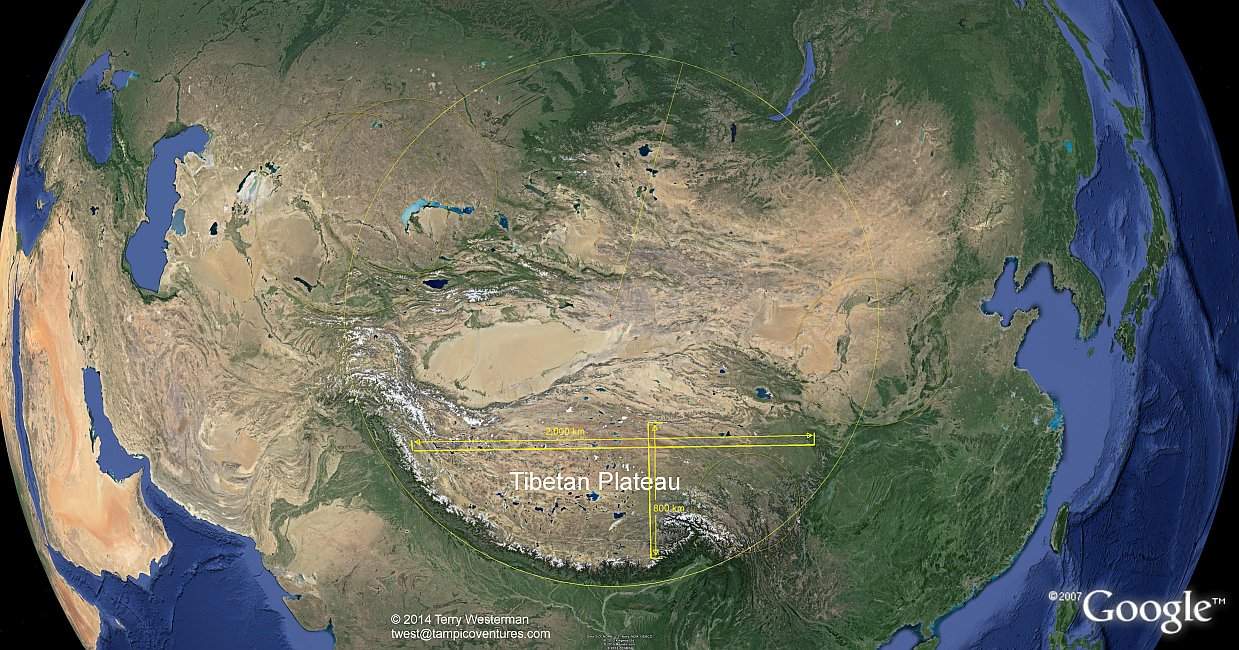
If we consider that the Tibetan Plateau is roughly 2,000 kilometers East/West, and 800 kilometers North/South, and that the Tibetan Plateau is about 4,000 meters above the surrounding landscape, then: 2000 x 800 x 4 = 6.400,000 cubic kilometers.
However, as its' diameter was much smaller than the Earth's, its' gravity would also be much less, in proportion to its' mass. It is very likely then that its' density was far less before impact, therefore its' size probably was much larger. |
|||||||||||||||
|
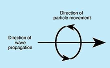
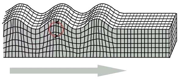
These waves travel out from the center at tremendous velocity. They move similar to the waves in the ocean.> While the surface of the wave moves up and down, the inside of the wave moves in a circular patern.
|