| Advisory | If
you arrived here by any means other than from the Index of Impacts, it is suggested that you start at the Introduction to gain an understanding of what follows. |
The Baffin Island Impact
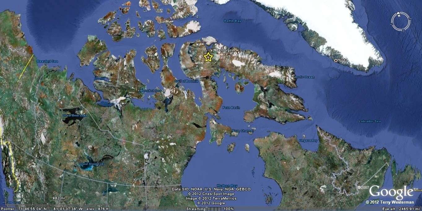
This impact, noted by the yellow star, struck the western part of Baffin Island, in the far northern Canadian Providence of Nunavut. It was centered at 71°45"N, 80° 51'W. This impact was literately heard around the world, and probable several times. Of necessity, only the most outstanding features of this catastrophic event are shown.
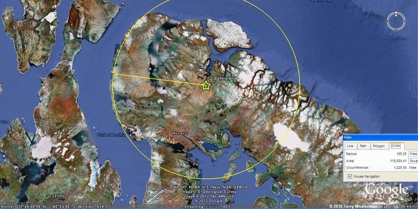
This is the 195 mile seismic circle. It describes the west coast of Baffin Island. It appears that the wave left a valley that now is the Gulf of Boothia.
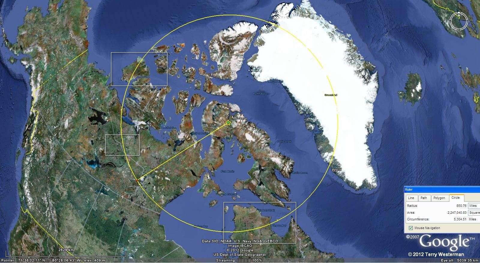
The 850 mile radius circle in its' entirety. The boxed areas in the image are shown in detail to the right.
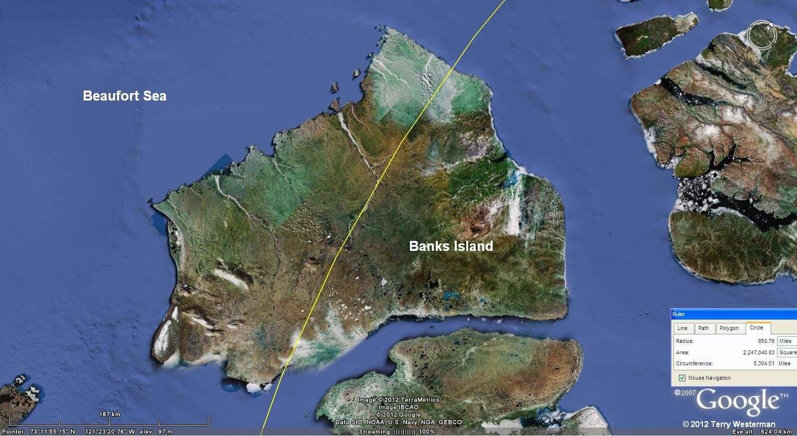
At 850 miles to the Northwest through Banks Island, a close examination will show a river that defines this circle.
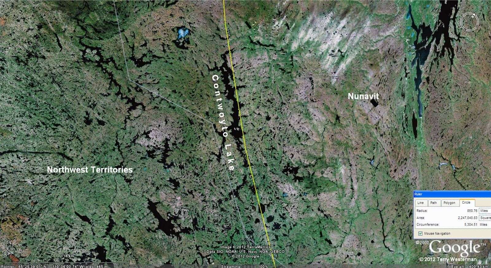
At 850 miles to the West southwest of the impact, Contwoyto Lake and the smaller following lakes mark this seismic circle for 100 miles
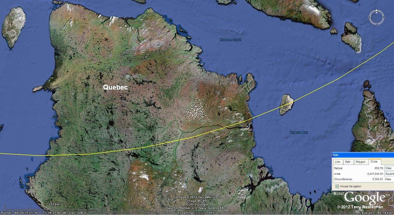
Through northern Quebec the Arnaud River valley is evidence of the passing of the seismic wave.

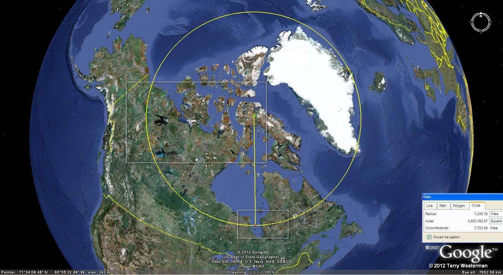
The 1245 mile radius circle. Again, the boxed areas in the image are shown in detail to the right.
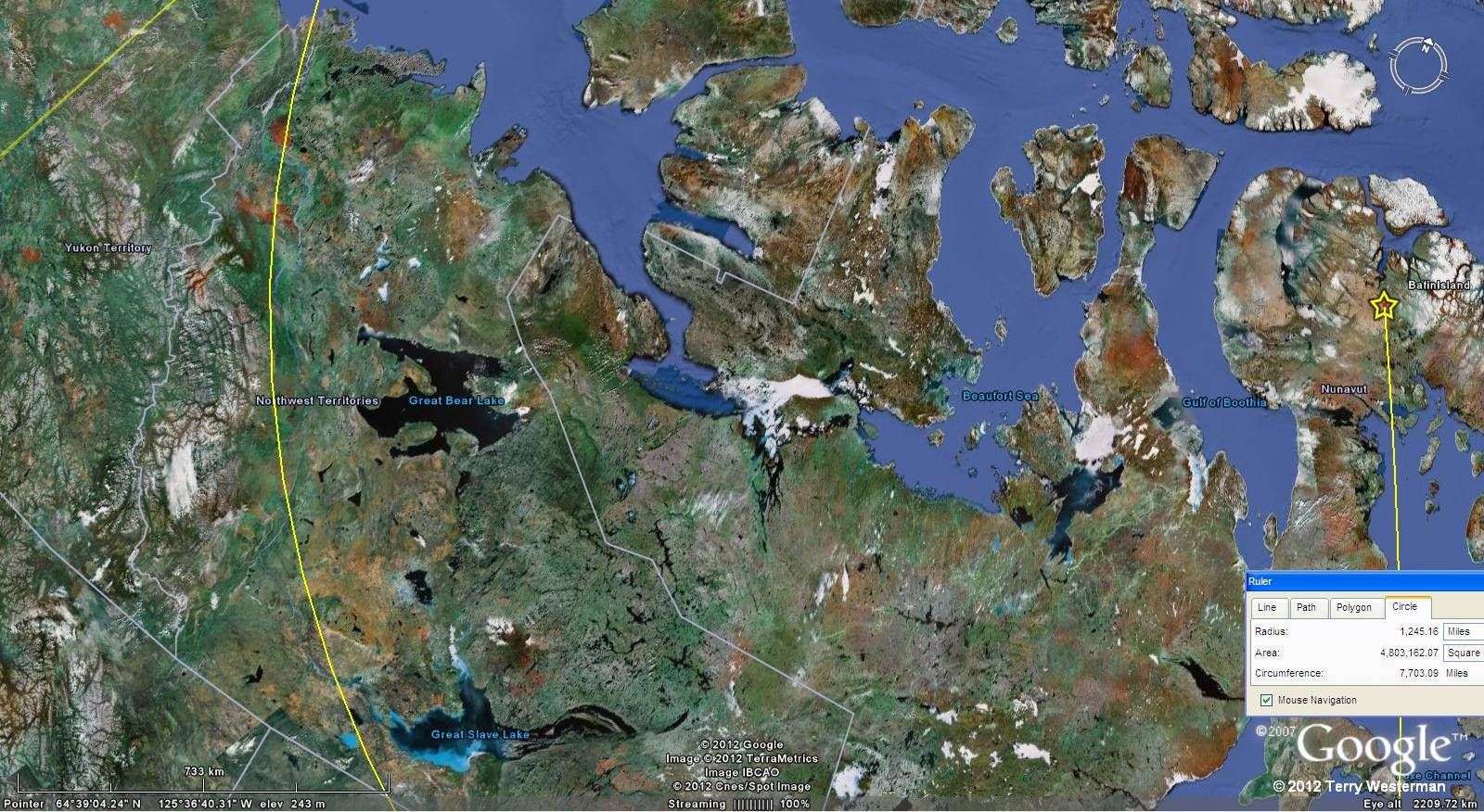
At 1245 miles to the West, the Mackenzie River follows the circle from Great Slave Lake to the Bearing Sea, about 800 miles. The image above is linked to a larger image for more detail.
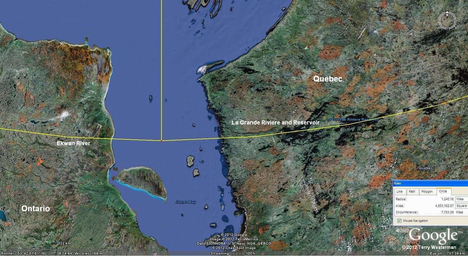
To the South, the seismic wave left behind the valley which became La Grande Riviere Reservoir when La Grande Riviere was damed at Radisson, Quebec. To the West of James Bay the Ekwan River in Ontario follows the valley.

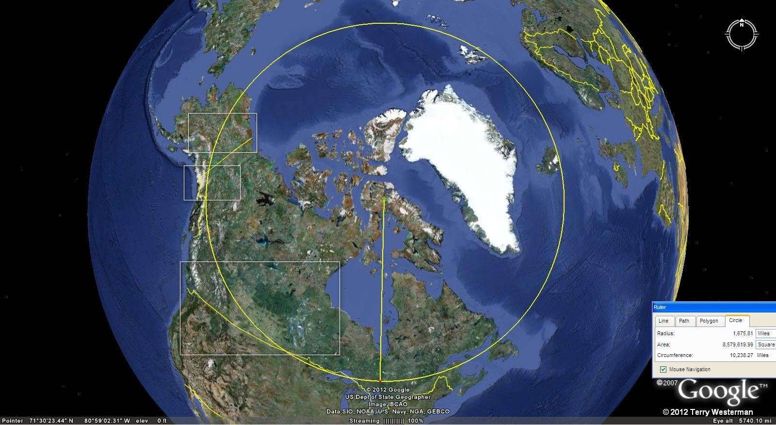
At 1675 miles radius.
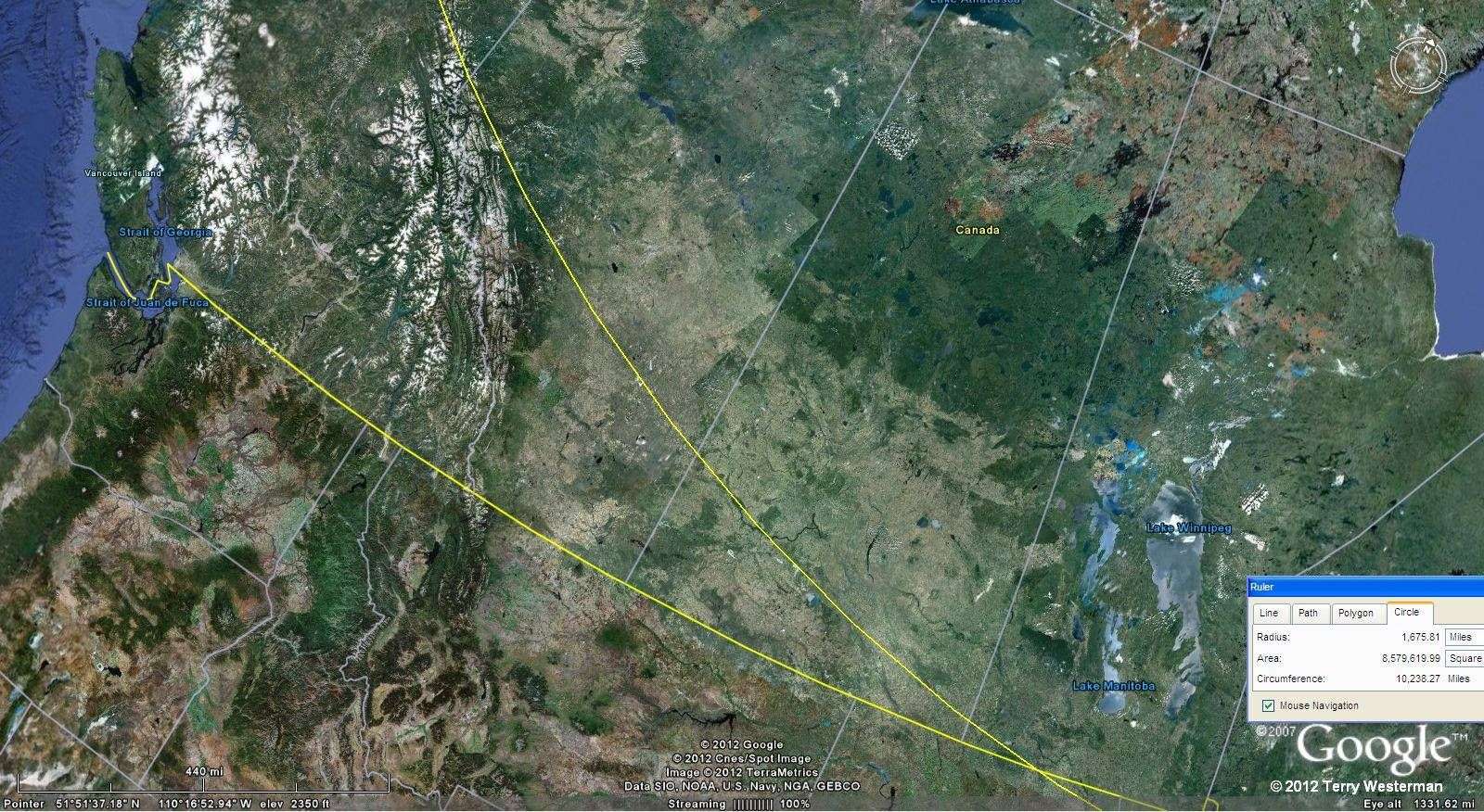
Through southwestern Canada the wave formed the northeastern edge of the Canadian Rocky Mountains, and farther to the southeast, the South Saskatchewan River flows in this valley.
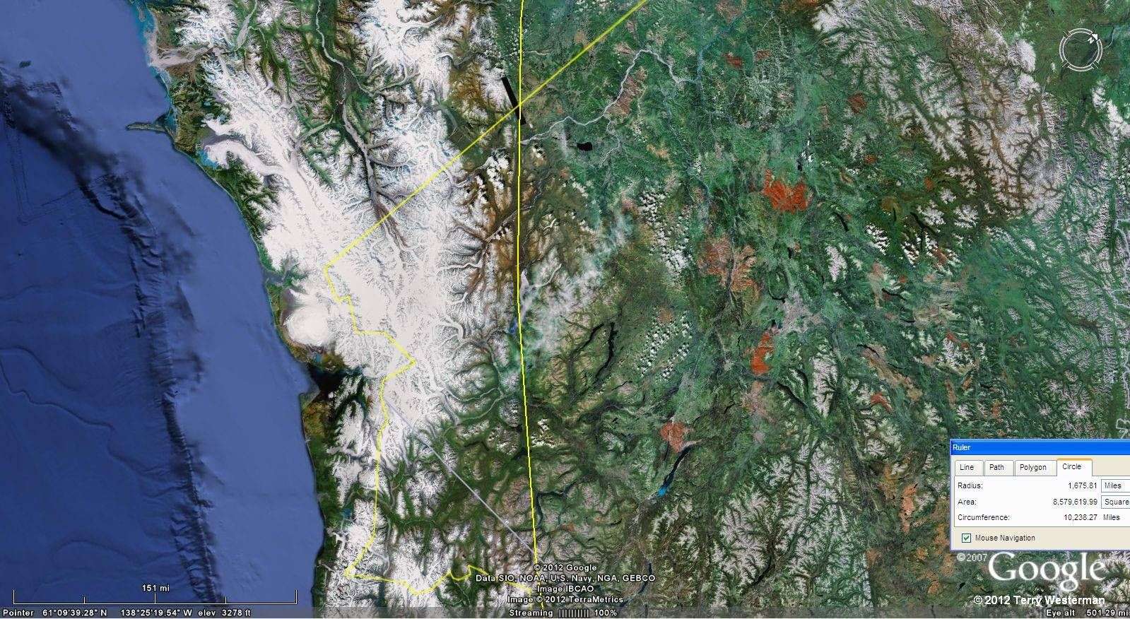
Through British Columbia, the Yukon Territory, and into Alaska.
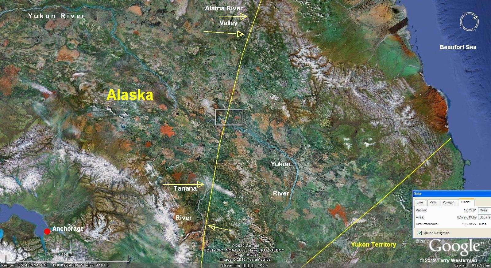
Through Alaska, the Tanana River follows the circle on the lower part of the image. In the upper part of the image the Alatna River Valley was formed by this wave. The rectangle in the center is shown expanded in the image to the left.
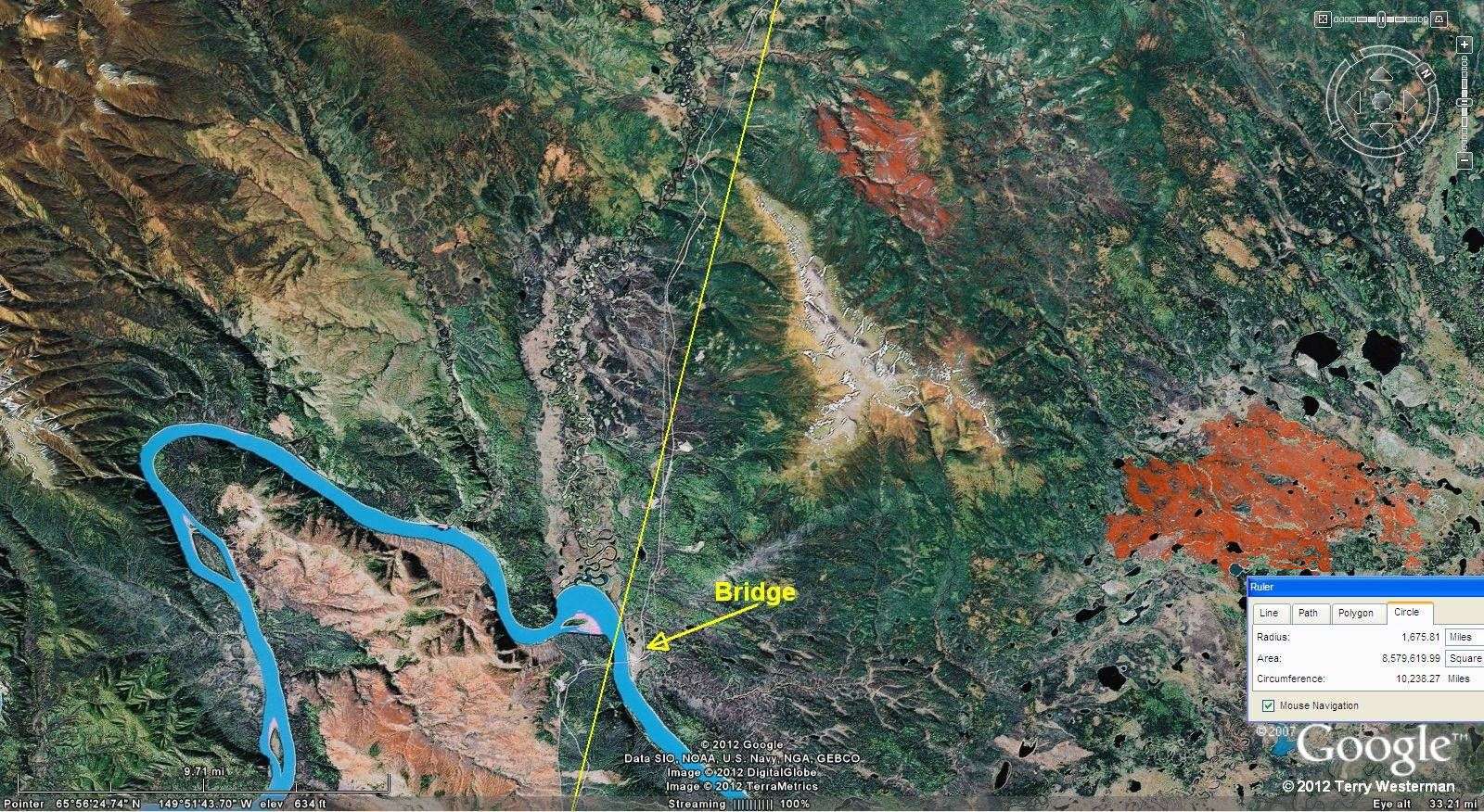
Of all the places on the Yukon River in Alaska, the engineers decided to bridge it at this seismic junction. The roads are visible to the north and south of the bridge, which follow the valley of the circle.

3360 mile radius not shown.
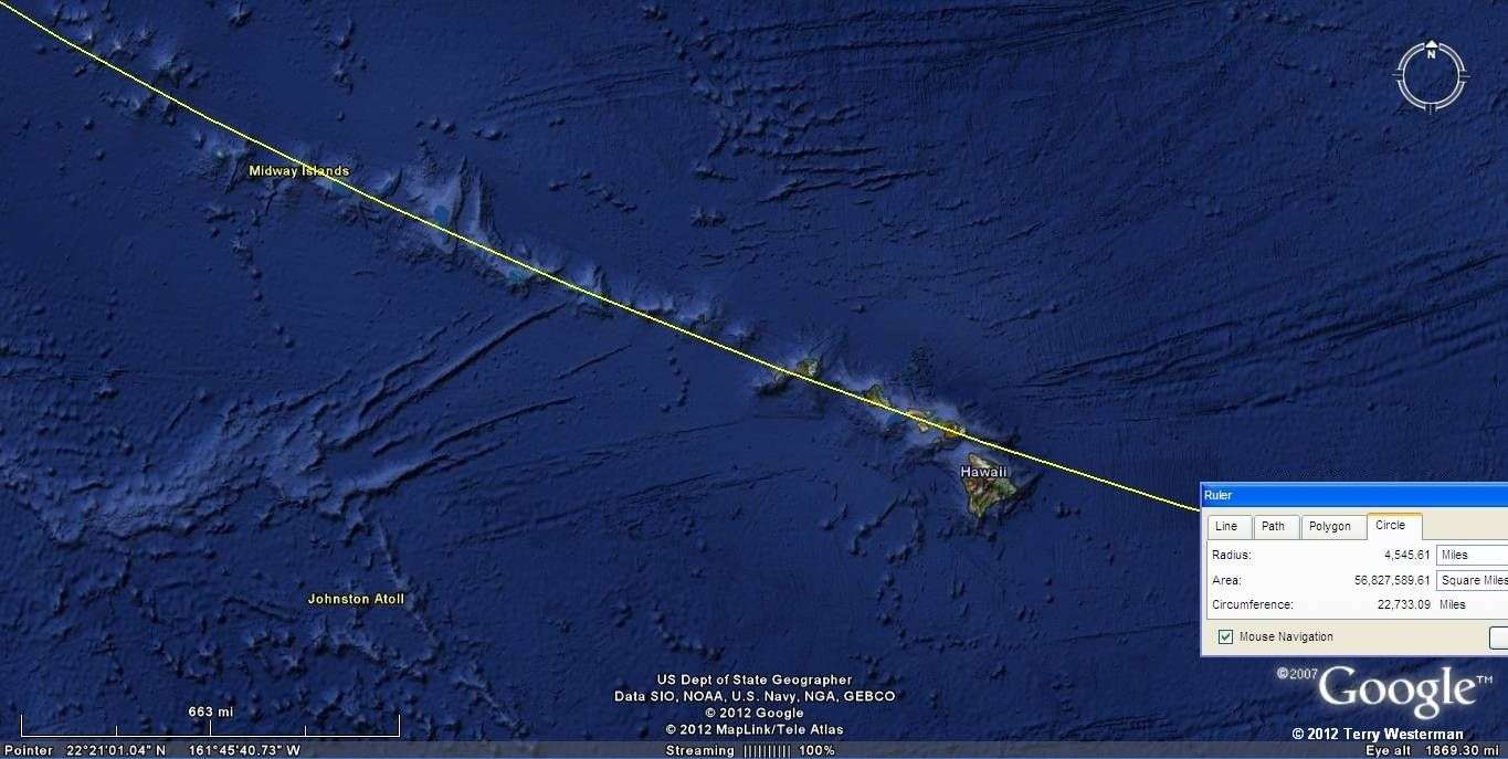
At 4545 miles radius, the seismic circle cracked the earth so that the Hawaiian ans Midway Islands chain of volcanoes was formed. The Burma Impact seismic circle at 10515 kilometers also passes through the Big Island of Hawaii, which may explain why it is bigger than the rest.
.
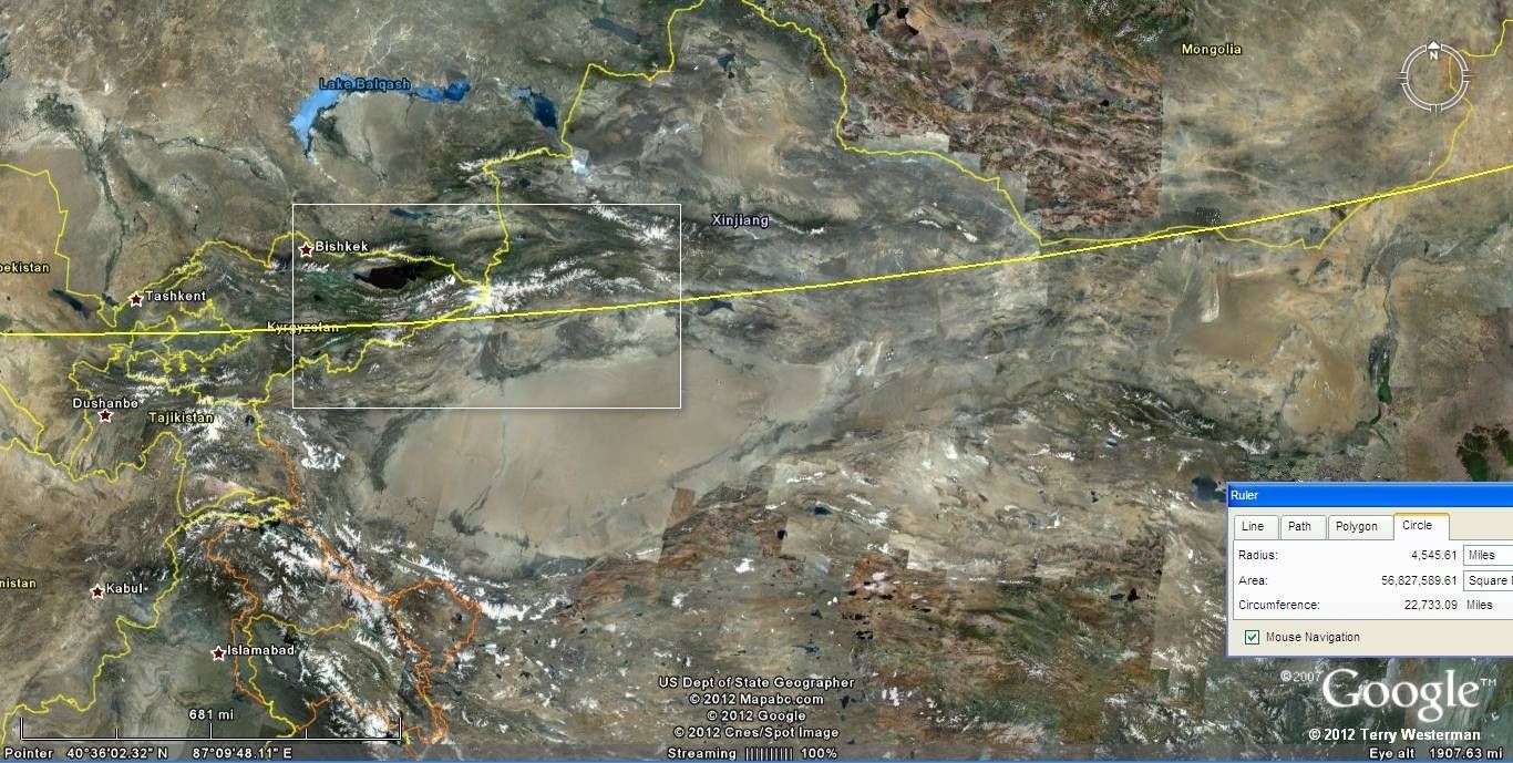
This same circle line at 4545 miles radius extended through the mountains of central Asia and north of the Taklamakan Desert and forms part of the boundary between Mongolia and China. The area in the rectangle is shown below.
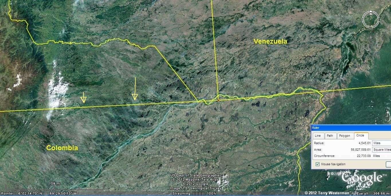
At the same 4545 mile radius, in South America, the Rio Negro forms part of the boundary between Colombia and Venezuela.

The image to the right is part of the image above it, to a larger scale, through the Tian Shan Mountains in Kyrgyzstan and Western China is at an effective altitude of 500 miles. This is an extremely wide image which covers nearly 575 miles West to East. To show this detail at that altitude demonstrates the significance of this impact.
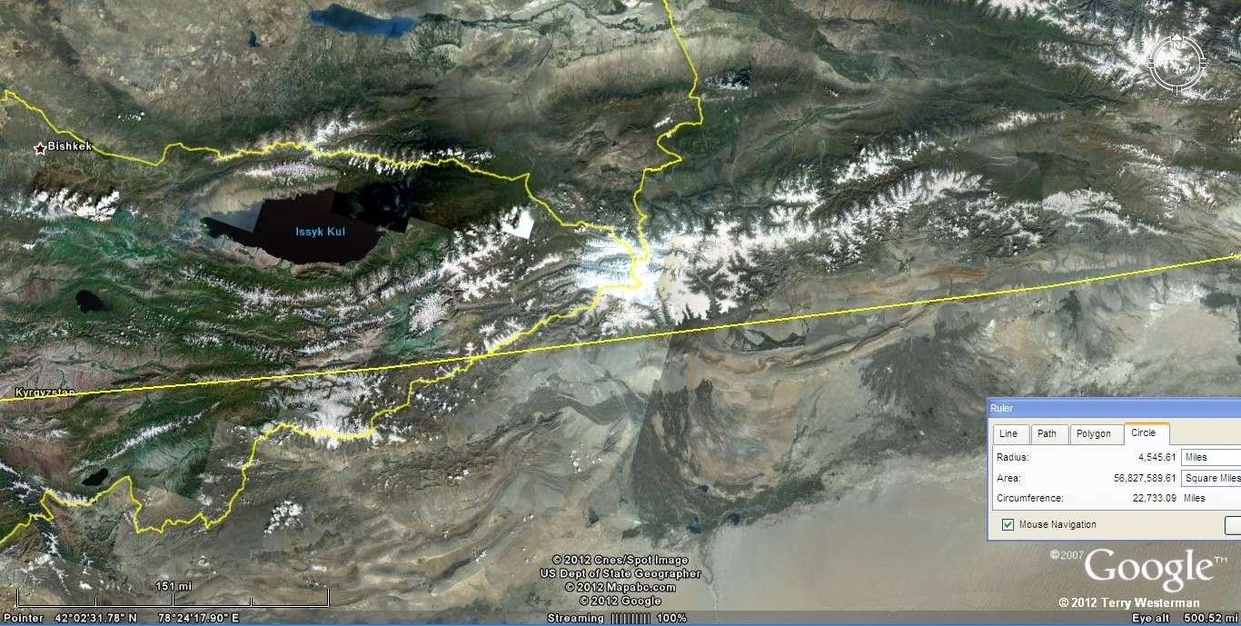
An expanded version of this image is shown
below.


At 4545 miles distance through the mountains of central Asia and north of the Taklamakan Desert. This is part of the image above in a larger scale.
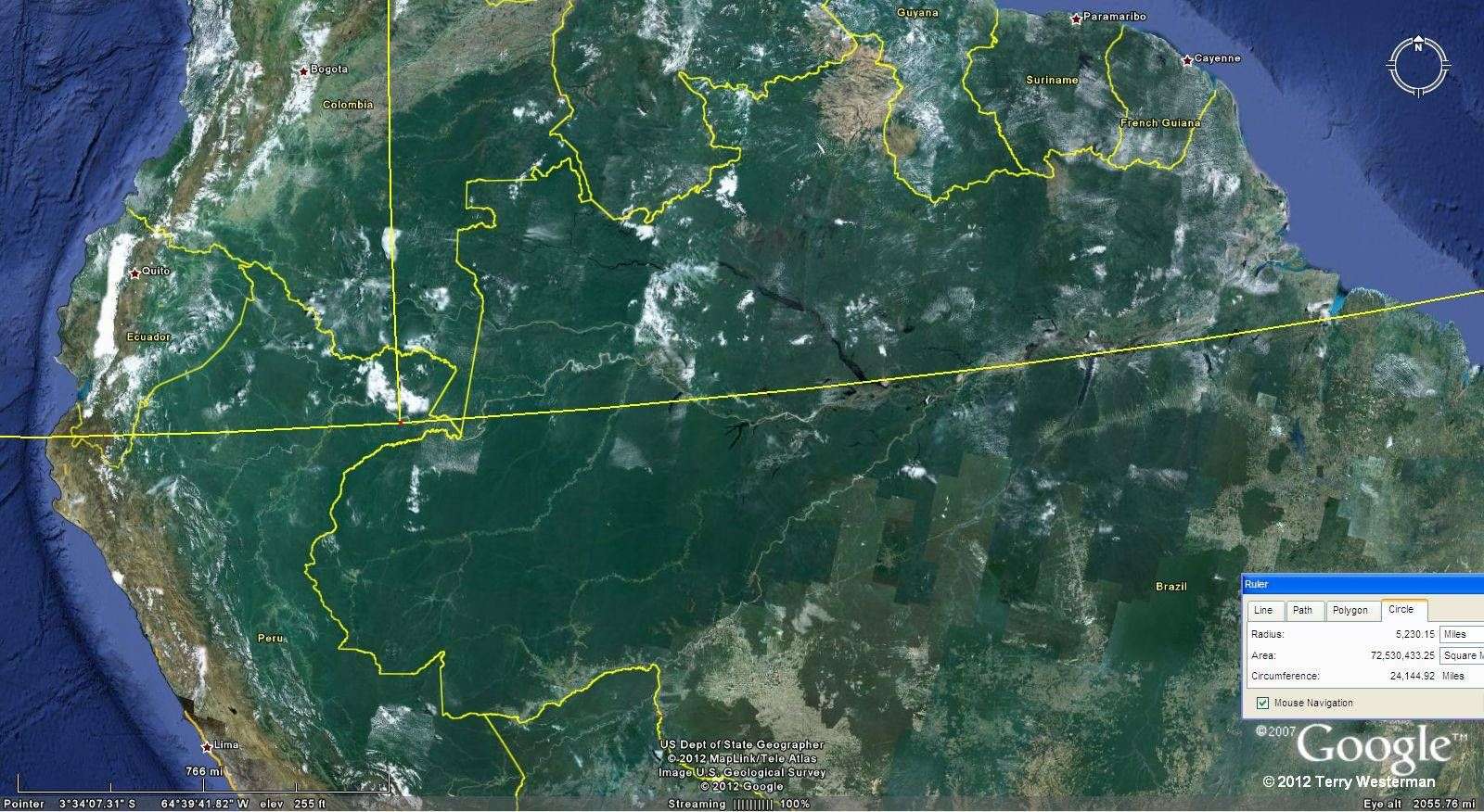
In South America, through Brazil at 5230 Miles radius, the main channel of the Amazon River was formed. The central part of this image is shown at increased size to the right.


The primary channel of the Amazon River.
The Image to the right
shows the wave at 7010 miles radius in the South Pacific, which defines
the ridge that crosses the Pitcairn Islands.
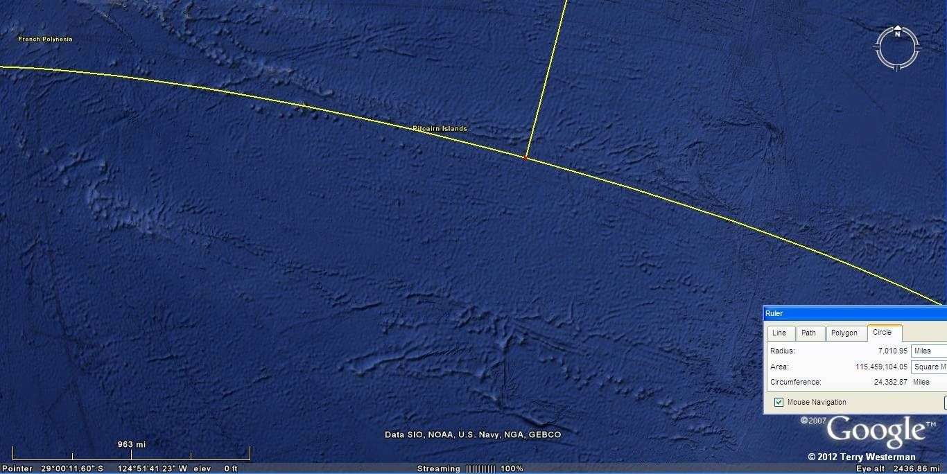

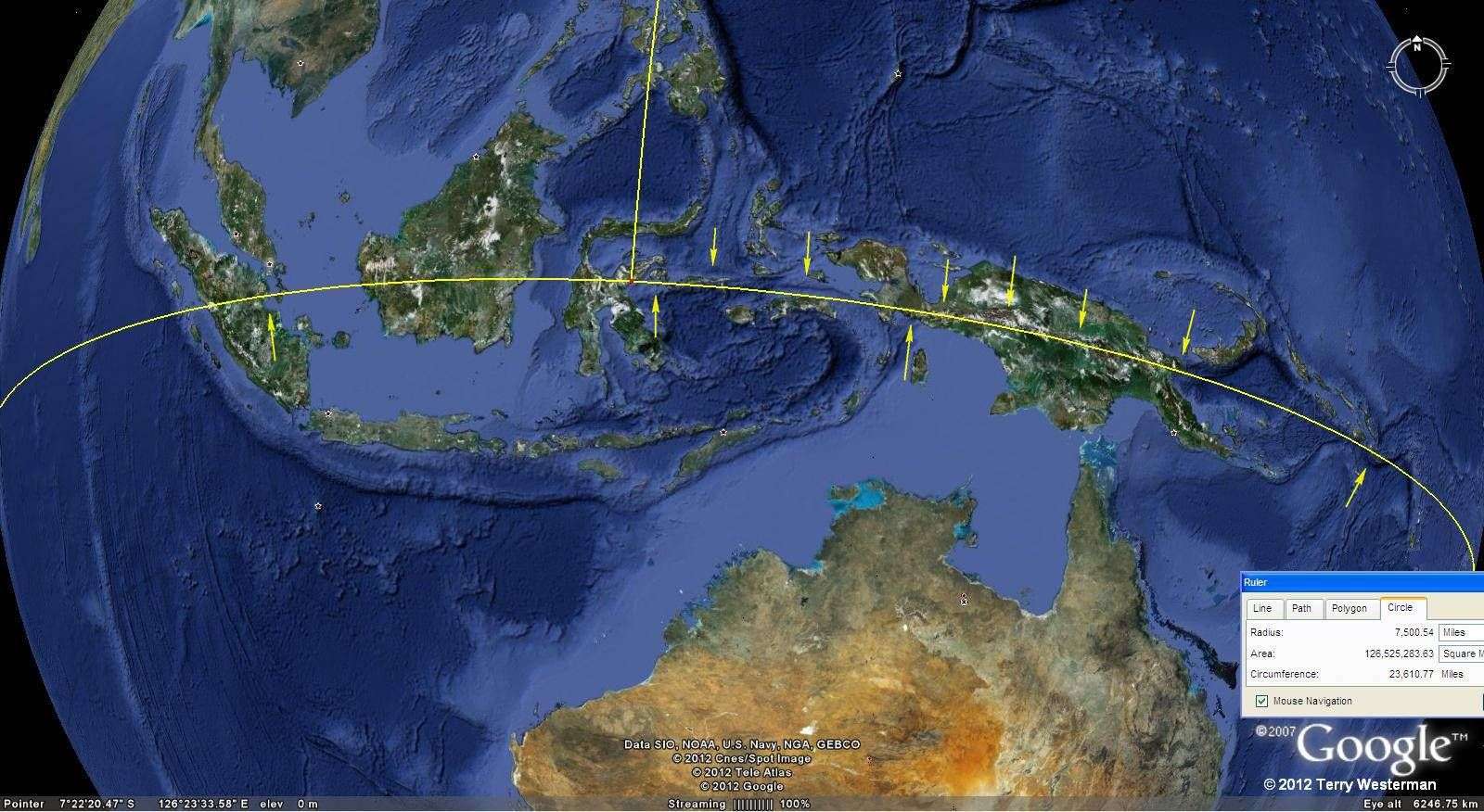
At 7500 miles radius, North of Australia, through Papua New Guinea and Indonesia, this circle defines much of the form of this part of the world.
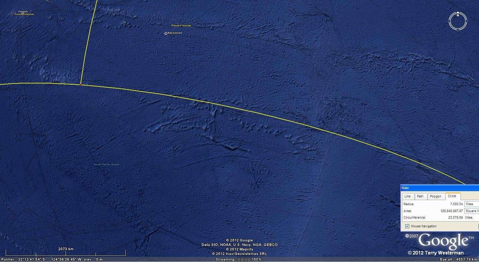
At 7500 miles radius through the South Pacific Ocean. This line follows the ridges for about 4,000 miles.

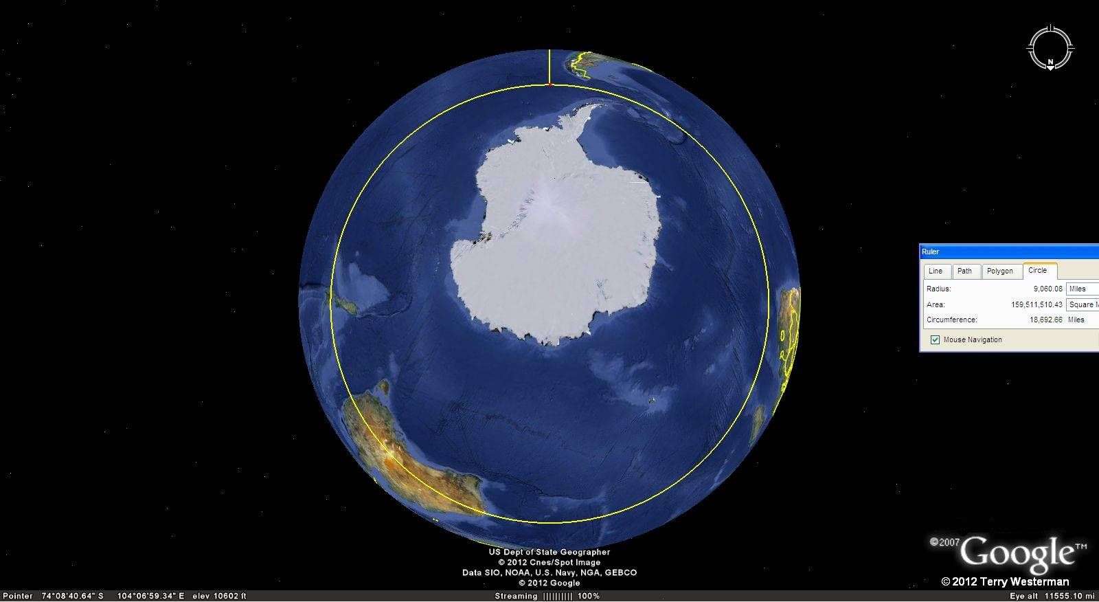
At 9060 miles radius, the Baffin Island Impact shows this seismic circle around Antarctica. South America is at the top, Africa at the right, and Australia to the lower left.
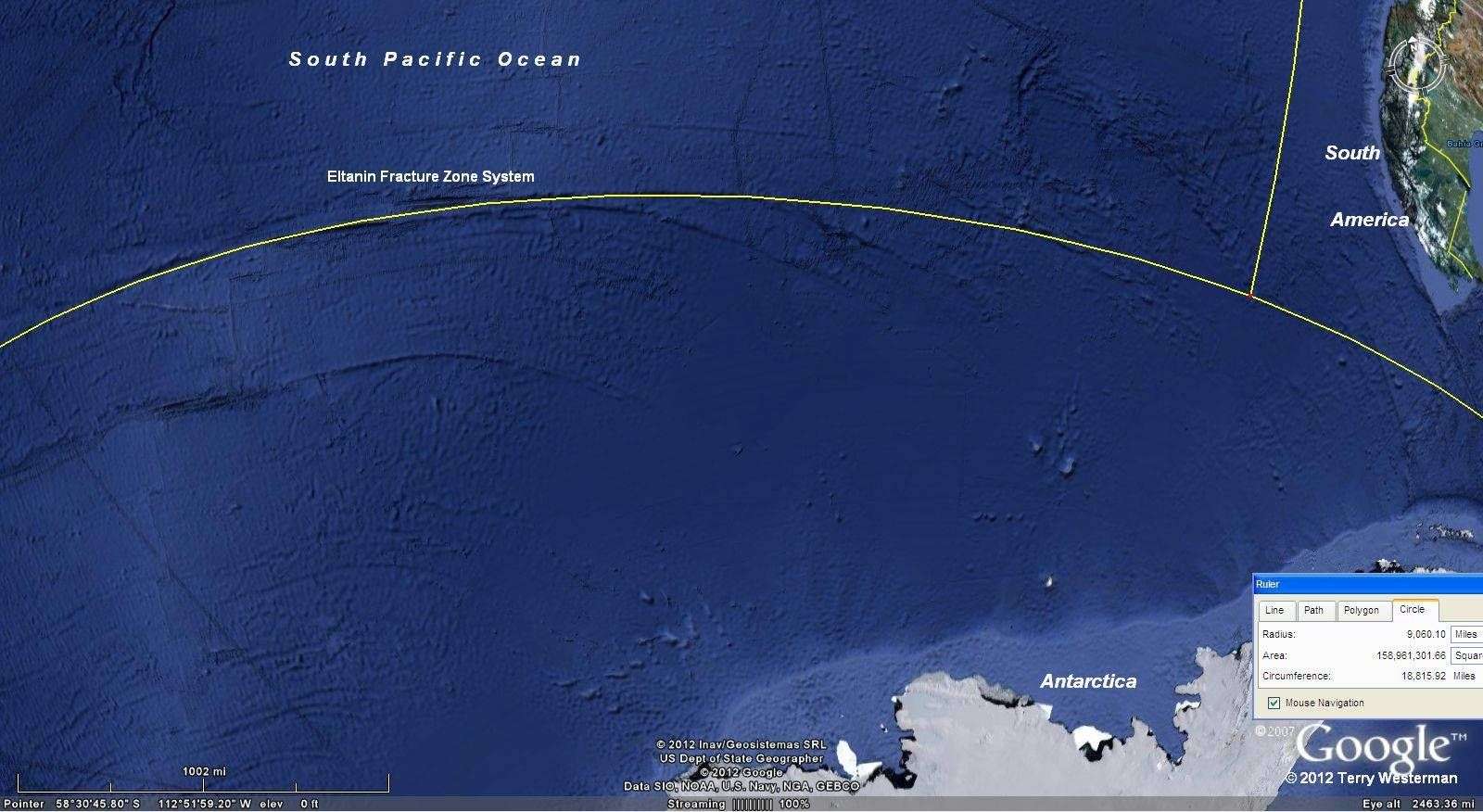
At 9060 miles radius through the South Pacific Ocean, this circle defines the Eltanan Fracture Zone System.
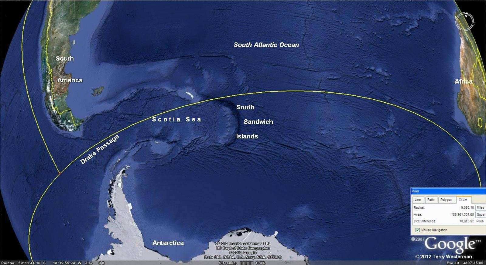
As this seismic circle passes through the center of Drake Passage between the southern tip of South America and Antarctica, it is possible that before this impact, the two continents were joined, and with this wave the land bridge broke, allowing the Pacific Ocean to flow to the Atlantic. With the ensuing flood, Drake Passage, the Scotia Sea and the South Sandwich Islands were formed.
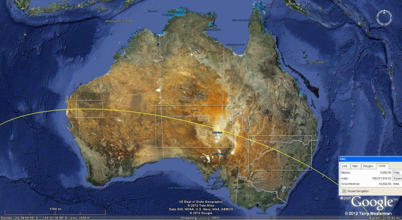
There is considerable evidence of this seismic circle across Australia. The rectangles in the image above are shown is greater detail to the right.
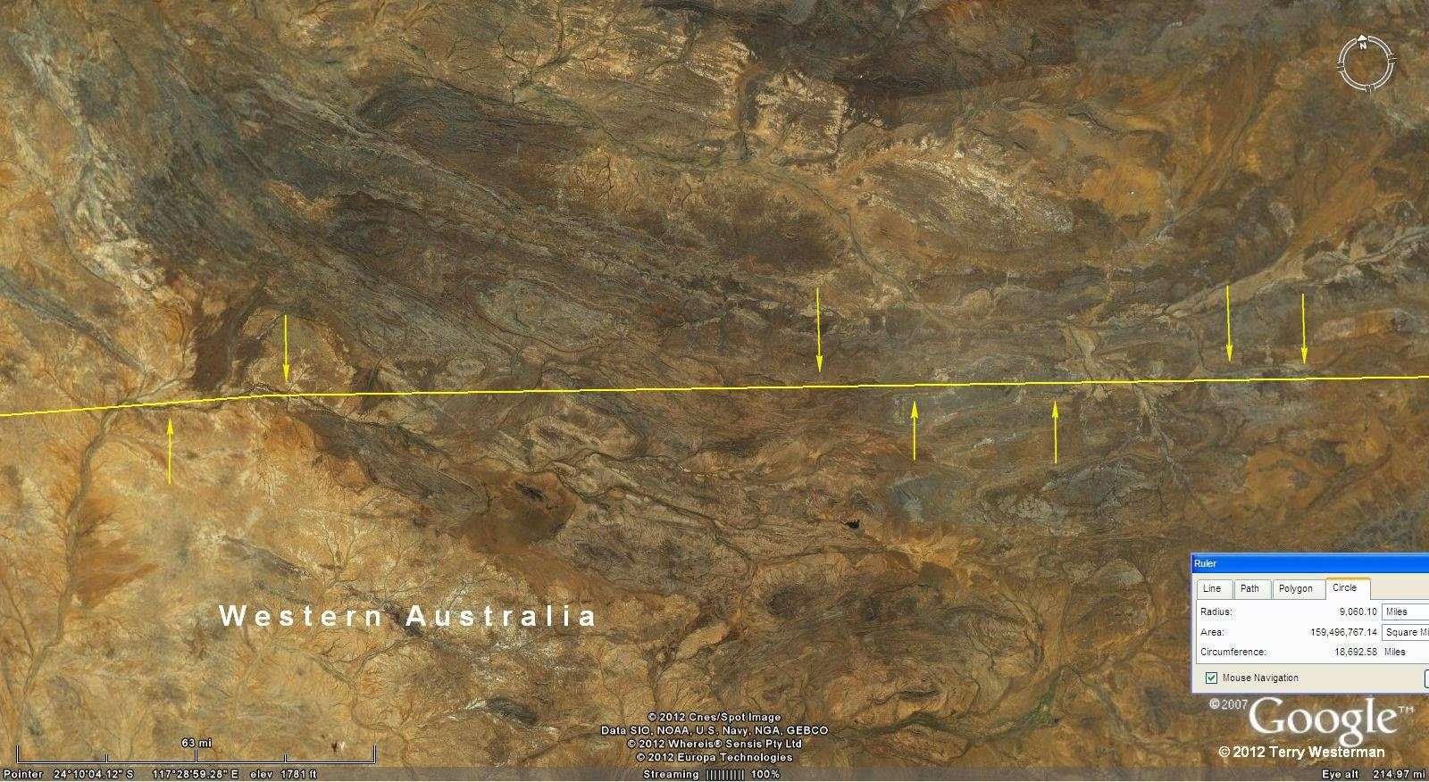
Through Western Australia. These images are expandable by 2x without loss of definition.
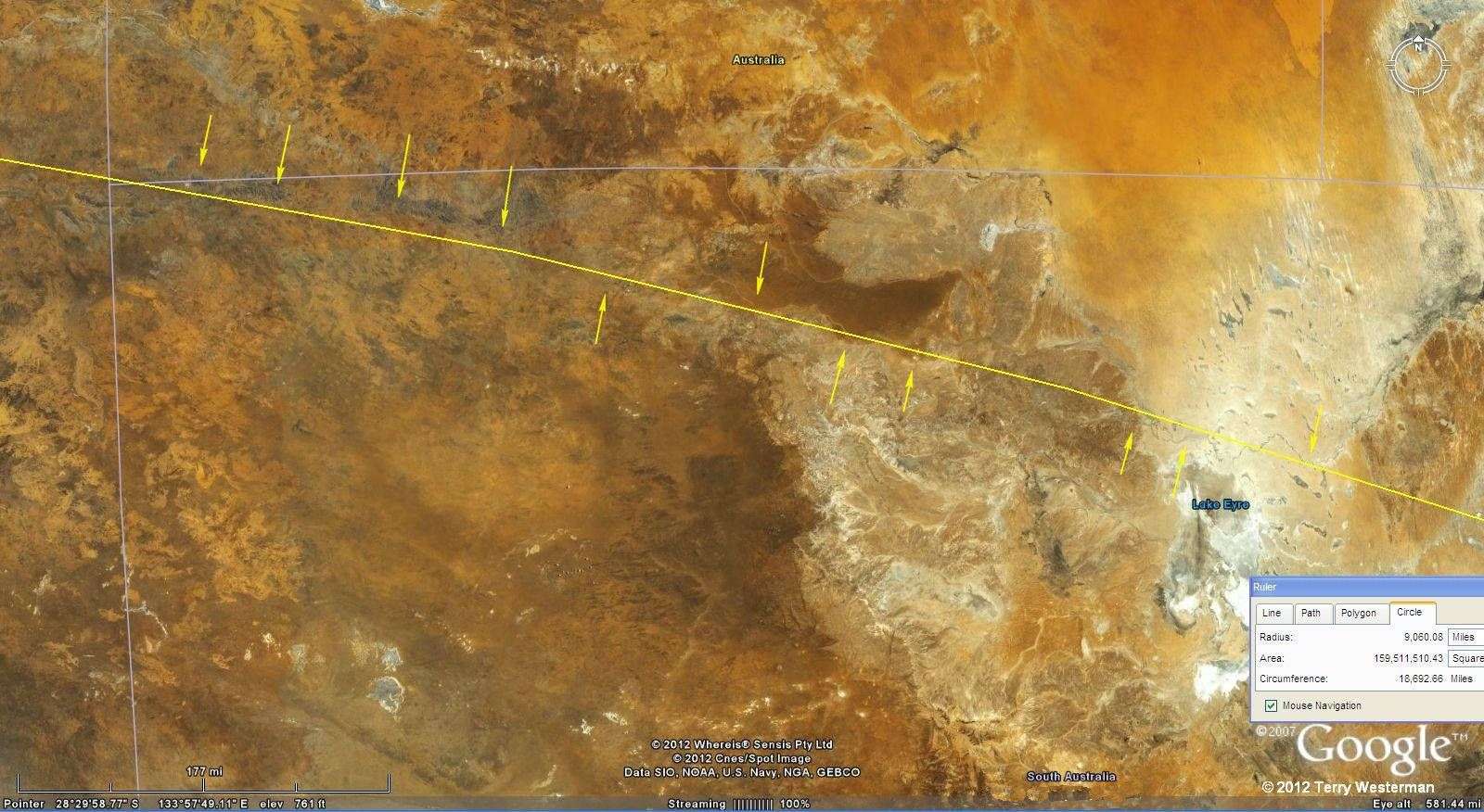
Through South Australia.

Through New South Wales, Australia.

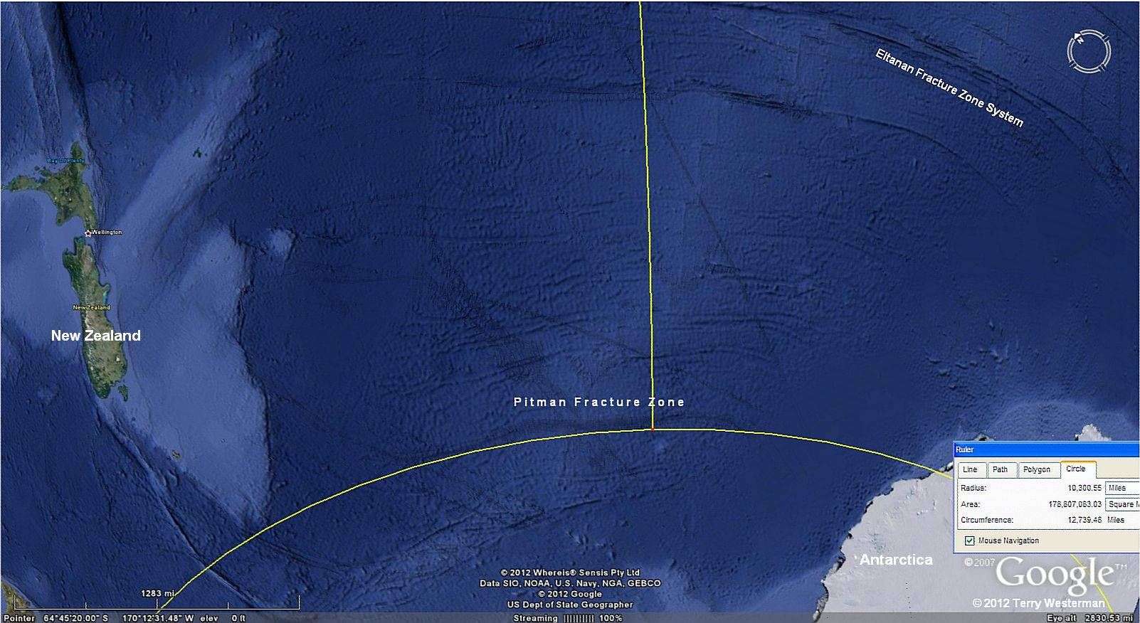
To the right, the Pitman Fracture Zone, which lies at 10,300 miles radius. New Zealand is on the left, Antarctica to the lower right and the Eltanan Fracture Zone System is on the upper right.
